Mires of the Schwarzenberg
Mires of the Schwarzenberg
- País:
- Austria
- Número del sitio:
- 1369
- Superficie:
- 267.0 ha
- Fecha de designación:
- 02-02-2004
- Coordenadas:
- 47°04'59"N 13°46'59"E
Los materiales presentados en este sitio web, particularmente los mapas y la información territorial, se proporcionan tal cual y según están disponibles a partir de los datos de los que se dispone y no implican la expresión de opinión alguna por parte de la Secretaría de la Convención de Ramsar respecto de la condición jurídica de ningún país, territorio, ciudad o zona, ni de sus autoridades, ni respecto de la delimitación de sus límites o fronteras.
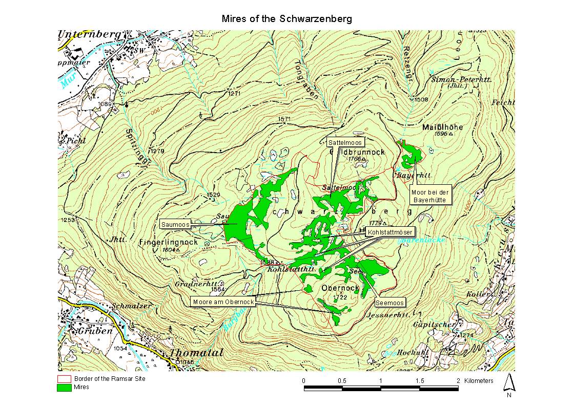
Mires of the Schwarzenberg. 02/02/04; Salzburg; 267 ha; 47°05'N 013°47'E. In the subalpine continental climate similar to the boreal, the plateau summit of the Schwarzenberg (1730m) has offered ideal conditions for the development of a natural mire complex of about 80 ha showing typical features of both boreal and alpine peatlands. Paludification mires, spring fens, percolation mires, Aapa mires and bogs present a high biodiversity of plant communities. Boreal vegetation such as the Dwarf Birch (Betula nana), bog cranberry species (Vaccinium microcarpum, Vaccinium oxycoccos) and the Crowberry-Brown Peatmoss (Empetro hermaphroditi-Sphagnetum fusci) are frequent occurrences, as is typical peatland vegetation like Carex pauciflora, Drosera rotundifolia, Menyanthes trifoliata and numerous Sphagnum species. The management authority (Austrian Federal Forestry) intends that there will be no peat extraction, no drainage of mires, no building of forestry roads affecting them, but a non-intensive forestry in the marginal forests and the preclusion of grazing and trampling of the mires. Ramsar site no. 1369. Most recent RIS information: 2003.
Región administrativa:
Salzburg
Fecha de última publicación:
02-02-2004
Ficha Informativa de los Humedales de Ramsar (FIR)
- AT1369RIS.pdf
- AT1369_map161128.jpg
- AT1369_taxo161128.pdf
Mapa del sitio
Informes y documentos adicionales
Taxonomic lists of plant and animal species occurring in the site
Other published literature