Bahía Lomas
Bahía Lomas
- Pays:
- Chili
- Numéro du site:
- 1430
- Superficie:
- 58,946.0 ha
- Date d'inscription:
- 06-12-2004
- Coordonnées:
- 52°37'59"S 69°10'W
Carousel
Carousel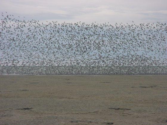
Le matériel présenté sur ce site web, et en particulier les cartes et l’information territoriale, est tel qu’il apparaît dans les données disponibles et n’implique en aucune manière l’expression d’une opinion quelconque de la part du Secrétariat de la Convention de Ramsar concernant le statut juridique de tout pays, territoire, ville ou zone, ou de ses autorités, ou concernant la délimitation de ses frontières ou limites.
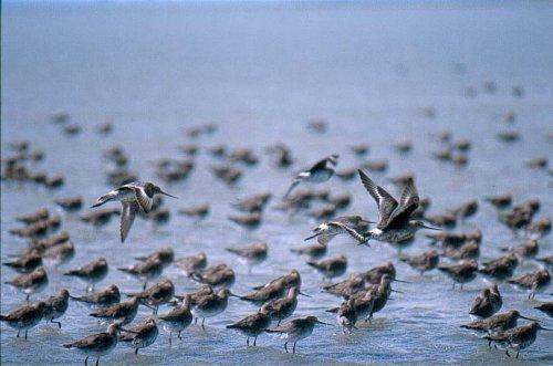
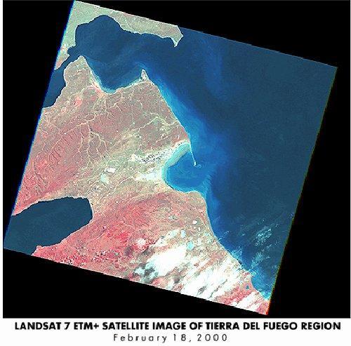
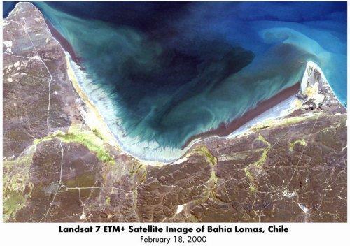
Bahía Lomas. 06/12/04; Región de Magallanes y Antártica Chilena, 58,946 ha; 52°38'S 069°10'W. Located in northern Tierra del Fuego Island, Ramsar's second southernmost site lies on the border with Argentina and faces the Magellan Strait. It features the largest intertidal flats in Chile, fronting a 69 km long beach and several salt marshes. The bay is renowned for its high concentrations of migratory shorebirds from October to March, with records of more than 41,000 Red Knots Calidris canutus, over 88% of the population in the Americas; 4,500 Hudsonian Godwits Limosa haemastica, 23% of the global population; 12,000 White-rumped Sandpipers Calidris fuscicollis, 3% of global population, as well as near threatened species such as the Magellanic Plover Pluvianellus socialis and the Chilean Flamingo Phoenicopterus chilensis. Precipitation is scarce and vegetation is typical of the Patagonian steppe, dominated by the grasses Festuca pallescens and F. gracillima. Large cetaceans have frequently stranded in the flats, with 21 species recorded. Human population is very scarce and sheep grazing is the main activity, as well as oil extraction from two platforms within the flats. The impact of pollution from oil spills from large vessels as well as from the platforms is a concern, but fortunately there is large recirculation of water thanks to the prevailing currents. Ramsar site no. 1430. Most recent RIS information: 2004.
Région administrative:
Región de Magallanes y Antártica Chilena
Date de dernière publication:
06-12-2004
Fiche descriptive Ramsar (FDR)
- CL1430RIS.pdf
- CL1430map_over.pdf
Carte du site
Rapports et documents complémentaires
Other published literature