Warta River Mouth National Park
Warta River Mouth National Park
- Pays:
- Pologne
- Numéro du site:
- 282
- Superficie:
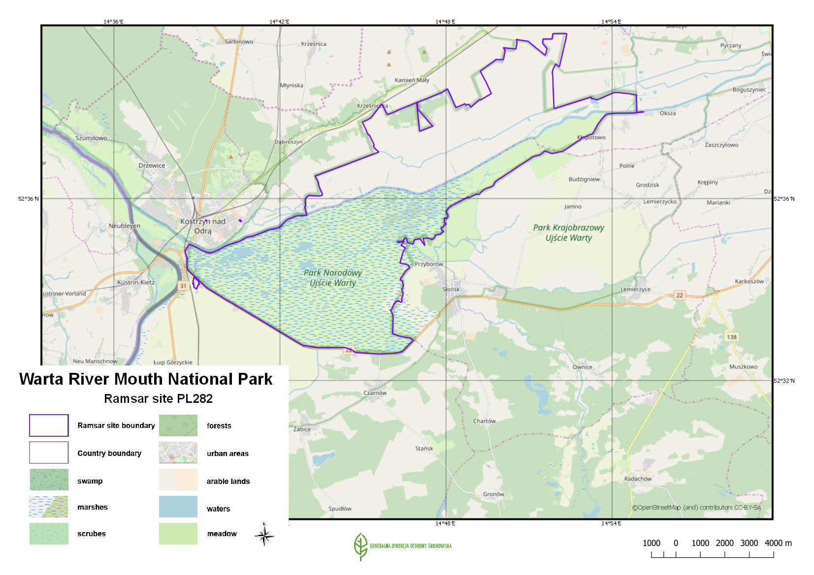
- 7,956.0 ha
- Date d'inscription:
- 03-01-1984
- Coordonnées:
- 52°35'51"N 14°46'12"E
Carousel
Carousel


Le matériel présenté sur ce site web, et en particulier les cartes et l’information territoriale, est tel qu’il apparaît dans les données disponibles et n’implique en aucune manière l’expression d’une opinion quelconque de la part du Secrétariat de la Convention de Ramsar concernant le statut juridique de tout pays, territoire, ville ou zone, ou de ses autorités, ou concernant la délimitation de ses frontières ou limites.
The Site covers the Warta River floodplain, near the border with Germany, and the surrounding marshes, meadows and pasture. It is one of the most important areas for waterfowl in Central Europe. The Park has a characteristic open landscape of seasonally flooded meadows and pastures, dotted with willows and criss-crossed by a dense network of river channels, ditches, canals, oxbows and small reservoirs. The annual fluctuation in the river level is as great as 3.5 metres, and the regular flooding favours the development of particular vegetation which creates the appropriate conditions for supporting a large concentration of migrating birds. It is also an important moulting site for geese, ducks, swans and cranes, and of the 279 species of bird recorded within the Park, more than 170 use the Site for breeding. An education centre, which organizes activities such as excursions and lectures, is found in the management headquarters of the Site. As of 2018, a management plan was being prepared.
- National Park - Warta River Mouth
- UE Natura 2000
- PL282RIS_1907_en.pdf
- PL282RISformer.pdf
- PL282RISformer_170710.pdf
- PL282_map180928.png