RIS Search

Map

Choose map: | | Download Centroids / Boundaries / Map (pdf)
Materials presented on this website, particularly maps and territorial information, are as-is and as-available based on available data and do not imply the expression of any opinion whatsoever on the part of the Secretariat of the Ramsar Convention concerning the legal status of any country, territory, city or area, or of its authorities, or concerning the delimitation of its frontiers or boundaries.

List

  1. Butrint
    Butrint
    Butrint
    Butrint
    Butrint

    Butrint

    • Country: 
      Albania
    • Designation date: 
      28-03-2003
    • Site number: 
      1290
    • Published since: 
      21 year(s)
    13,500 ha
  2. -

    Duinen Vlieland

    • Country: 
      Netherlands (Kingdom of the)
    • Designation date: 
      29-08-2000
    • Site number: 
      2216
    • Published since: 
      2 year(s)
    1,484 ha
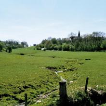
  3. Vallée de la Haute-Sûre

    • Country: 
      Luxembourg
    • Designation date: 
      08-03-2004
    • Site number: 
      1408
    • Published since: 
      21 year(s)
    16,900 ha
  4. Ramsar logo

    Rheindelta

    • Country: 
      Austria
    • Designation date: 
      16-12-1982
    • Site number: 
      275
    • Published since: 
      19 year(s)
    2,065 ha
  5. Hammarmaden in the nature reserve Kvismaren.
    Sörby pasture nearby east Kvismarern.
    View from Öby hill towards Kvismare channel.
    East part of Kvismaren.
    Platform at the north side of Lake Fågelsjön.
    Fiskinge, Kvismaren.
    Fiskingemaden, Kvismaren.
    Rysjön, west part of Kvismaren.

    Kvismaren

    • Country: 
      Sweden
    • Designation date: 
      05-12-1974
    • Site number: 
      24
    • Published since: 
      7 year(s)
    837 ha
  6. Cobourg Peninsula
    Cobourg Peninsula
    Pier at Black Point, Cobourg Peninsula

    Cobourg Peninsula

    • Country: 
      Australia
    • Designation date: 
      08-05-1974
    • Site number: 
      1
    • Published since: 
      2 year(s)
    220,700 ha
  7. Ramsar logo

    Bañados del Este y Franja Costera

    • Country: 
      Uruguay
    • Designation date: 
      22-05-1984
    • Site number: 
      290
    • Published since: 
      23 year(s)
    407,408 ha
  8. Ramsar logo

    Connecticut River Estuary and Tidal River Wetlands Complex

    • Country: 
      United States of America
    • Designation date: 
      14-10-1994
    • Site number: 
      710
    • Published since: 
      29 year(s)
    6,603 ha
  9. The Nagy-zsombék area in Montág-puszta

    Montág-puszta

    • Country: 
      Hungary
    • Designation date: 
      20-02-2008
    • Site number: 
      1746
    • Published since: 
      7 year(s)
    2,203 ha
  10. Glaver Koppel waterside in Winter
    View from the observation pulpit to the north over the Großer Werder in Krakow Upper Lake
    View from the Großer Werder to the Rauwerder in the Krakow Upper lake
    View to the southeast over the black-headed gull colony in the south of the Großer Werder in Krakow's Upper Lake

    Upper Lake Krakow

    • Country: 
      Germany
    • Designation date: 
      31-07-1978
    • Site number: 
      171
    • Published since: 
      0 year(s)
    893 ha

Pages

Stats


Exports

Export Sites information

For a summary list of all the Ramsar Sites in pdf format, click here.

Generate reports of selected Sites

You can generate a report based on the filters you have applied, in either pdf or xls format. The report will sort the results by the Site name, unless you have sorted them by another variable.

For the pdfs, you can choose whether to include the introductory text on each Site, or just show the key data in a shorter report.

To receive a report, please provide your email address and enter the text in the verification picture into the textbox.

As soon as the list has been generated an e-mail will be sent to you with the link to access the file.