Search results
Search found 83 Ramsar Sites covering 2,396,163 ha
- (-) Remove Region/country: Serbia filter Region/country: Serbia
- (-) Remove Region/country: Ukraine filter Region/country: Ukraine
- (-) Remove Region/country: Asia filter Region/country: Asia
- (-) Remove Threats: Biological resource use filter Threats: Biological resource use
- (-) Remove Region/country: Philippines filter Region/country: Philippines
- (-) Remove Ramsar criteria: 4 filter Ramsar criteria: 4
- (-) Remove Region/country: Nepal filter Region/country: Nepal
- (-) Remove Region/country: Albania filter Region/country: Albania
- (-) Remove Region/country: Bangladesh filter Region/country: Bangladesh
- (-) Remove Region/country: Armenia filter Region/country: Armenia
- (-) Remove Region/country: Ireland filter Region/country: Ireland
Map
Materials presented on this website, particularly maps and territorial information, are as-is and as-available based on available data and do not imply the expression of any opinion whatsoever on the part of the Secretariat of the Ramsar Convention concerning the legal status of any country, territory, city or area, or of its authorities, or concerning the delimitation of its frontiers or boundaries.
List
-
 is crossing a tidal creek in Bangladesh Sundarbans")
 is feeding on its prey in the Mangrove Swamp of Bangladesh Sundarbans")

 of Bangladesh Sundarbans")
 from the Sundarbans")
 are being harvested by people as thatch materials for roofing village houses")
 being transported to the Khulna Newsprint Mill from the Sundarbans as a pulpwood for manufacturing newsprint.")

 in the Sundarbans of Bangladesh")

Sundarbans Reserved Forest
-
Country:Bangladesh
-
Designation date:21-05-1992
-
Site number:560
-
Published since:21 year(s)
601,700 ha -
-
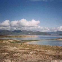


Lake Sevan
-
Country:Armenia
-
Designation date:07-06-1993
-
Site number:620
-
Published since:13 year(s)
490,231 ha -
-

Eastern Syvash
-
Country:Ukraine
-
Designation date:28-02-1997
-
Site number:769
-
Published since:26 year(s)
165,000 ha -
-


Karkinitska and Dzharylgatska Bays
-
Country:Ukraine
-
Designation date:11-10-1976
-
Site number:114
-
Published since:1 year(s)
147,557 ha -
-
Tubbataha Reefs Natural Park
-
Country:Philippines
-
Designation date:12-11-1999
-
Site number:1010
-
Published since:14 year(s)
96,828 ha -
-
Central Syvash
-
Country:Ukraine
-
Designation date:11-10-1976
-
Site number:115
-
Published since:26 year(s)
80,000 ha -
-


Djerdap
-
Country:Serbia
-
Designation date:08-06-2020
-
Site number:2442
-
Published since:3 year(s)
66,525 ha -
-


Tendrivska Bay
-
Country:Ukraine
-
Designation date:28-02-1997
-
Site number:768
-
Published since:1 year(s)
55,022 ha -
-


Lake Shkodra and River Buna
-
Country:Albania
-
Designation date:02-02-2006
-
Site number:1598
-
Published since:18 year(s)
49,562 ha -
-


Kyliiske Mouth
-
Country:Ukraine
-
Designation date:11-10-1976
-
Site number:113
-
Published since:1 year(s)
44,904 ha -