Search results
Search found 37 Ramsar Sites covering 2,481,680 ha
- (-) Remove Threats: Biological resource use filter Threats: Biological resource use
- (-) Remove Sites on Montreux record?: No filter Sites on Montreux record?: No
- (-) Remove Region/country: Oceania filter Region/country: Oceania
- (-) Remove Ramsar criteria: 4 filter Ramsar criteria: 4
- (-) Remove Ramsar criteria: 7 filter Ramsar criteria: 7
- (-) Remove Region/country: Latin America and the Caribbean filter Region/country: Latin America and the Caribbean
- (-) Remove Region/country: Europe filter Region/country: Europe
- (-) Remove Ramsar criteria: 3 filter Ramsar criteria: 3
- (-) Remove Threats: Logging and wood harvesting filter Threats: Logging and wood harvesting
- (-) Remove Region/country: Papua New Guinea filter Region/country: Papua New Guinea
- (-) Remove Region/country: Argentina filter Region/country: Argentina
Map
Materials presented on this website, particularly maps and territorial information, are as-is and as-available based on available data and do not imply the expression of any opinion whatsoever on the part of the Secretariat of the Ramsar Convention concerning the legal status of any country, territory, city or area, or of its authorities, or concerning the delimitation of its frontiers or boundaries.
List
-


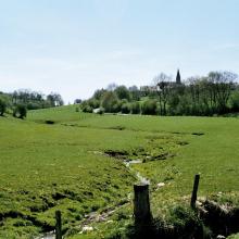
Marais Vernier et Vallée de la Risle maritime
-
Country:France
-
Designation date:18-12-2015
-
Site number:2247
-
Published since:8 year(s)
9,564 ha -
-


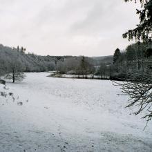
Vindelälven
-
Country:Sweden
-
Designation date:19-03-2013
-
Site number:2181
-
Published since:7 year(s)
66,395 ha -
-


Shagany-Alibei-Burnas Lakes System
-
Country:Ukraine
-
Designation date:28-02-1997
-
Site number:763
-
Published since:1 year(s)
27,600 ha -
-

Rába valley
-
Country:Hungary
-
Designation date:06-10-2006
-
Site number:1645
-
Published since:7 year(s)
9,552 ha -
-


Vallée de la Haute-Sûre
-
Country:Luxembourg
-
Designation date:08-03-2004
-
Site number:1408
-
Published since:21 year(s)
16,900 ha -
-

Bañados del Río Dulce y Laguna de Mar Chiquita
-
Country:Argentina
-
Designation date:28-05-2002
-
Site number:1176
-
Published since:21 year(s)
996,000 ha -
-


Northern Part of the Dniester Liman
-
Country:Ukraine
-
Designation date:28-02-1997
-
Site number:765
-
Published since:1 year(s)
25,929 ha -
-
Lake Kutubu
-
Country:Papua New Guinea
-
Designation date:25-09-1998
-
Site number:961
-
Published since:25 year(s)
4,924 ha -
-
Oberrhein / Rhin Supérieur
-
Country:Germany
-
Designation date:28-08-2008
-
Site number:1809
-
Published since:15 year(s)
25,117 ha -
-


Kugurlui Lake
-
Country:Ukraine
-
Designation date:28-02-1997
-
Site number:760
-
Published since:1 year(s)
13,493 ha -