Search results
Search found 27 Ramsar Sites covering 618,557 ha
- (-) Remove Region/country: Armenia filter Region/country: Armenia
- (-) Remove Region/country: Austria filter Region/country: Austria
Map
Materials presented on this website, particularly maps and territorial information, are as-is and as-available based on available data and do not imply the expression of any opinion whatsoever on the part of the Secretariat of the Ramsar Convention concerning the legal status of any country, territory, city or area, or of its authorities, or concerning the delimitation of its frontiers or boundaries.
List
-

Waldviertel ponds, peat bogs & floodplains
-
Country:Austria
-
Designation date:16-12-1999
-
Site number:1013
-
Published since:16 year(s)
13,000 ha -
-
Sablatnigmoor
-
Country:Austria
-
Designation date:04-05-1992
-
Site number:558
-
Published since:20 year(s)
96 ha -
-
Upper Drava River
-
Country:Austria
-
Designation date:06-05-2014
-
Site number:2208
-
Published since:10 year(s)
1,029 ha -
-
Rotmoos im Fuschertal
-
Country:Austria
-
Designation date:16-02-1995
-
Site number:719
-
Published since:21 year(s)
58 ha -
-


Khor Virap Marsh
-
Country:Armenia
-
Designation date:25-01-2007
-
Site number:1989
-
Published since:13 year(s)
50 ha -
-
Lake Arpi
-
Country:Armenia
-
Designation date:07-06-1993
-
Site number:621
-
Published since:13 year(s)
3,230 ha -
-
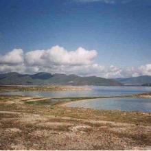


Lake Sevan
-
Country:Armenia
-
Designation date:07-06-1993
-
Site number:620
-
Published since:13 year(s)
490,231 ha -
-
Autertal - St. Lorenzener Hochmoor
-
Country:Austria
-
Designation date:02-08-2011
-
Site number:1979
-
Published since:13 year(s)
48 ha -
-
Bayerische Wildalm and Wildalmfilz
-
Country:Austria
-
Designation date:11-05-2005
-
Site number:1489
-
Published since:19 year(s)
133 ha -
-
Hörfeld-Moor
-
Country:Austria
-
Designation date:29-10-1996
-
Site number:864
-
Published since:20 year(s)
137 ha -