Search results
Search found 34 Ramsar Sites covering 737,008 ha
- (-) Remove Region/country: Europe filter Region/country: Europe
- (-) Remove Region/country: Asia filter Region/country: Asia
- (-) Remove Region/country: Latvia filter Region/country: Latvia
- (-) Remove Region/country: Greece filter Region/country: Greece
- (-) Remove Region/country: Spain filter Region/country: Spain
- (-) Remove Region/country: Armenia filter Region/country: Armenia
- (-) Remove Region/country: Japan filter Region/country: Japan
- (-) Remove Picture available?: Yes filter Picture available?: Yes
Map
Materials presented on this website, particularly maps and territorial information, are as-is and as-available based on available data and do not imply the expression of any opinion whatsoever on the part of the Secretariat of the Ramsar Convention concerning the legal status of any country, territory, city or area, or of its authorities, or concerning the delimitation of its frontiers or boundaries.
List
-


")


")
")

Yoshigadaira Wetlands
-
Country:Japan
-
Designation date:28-05-2015
-
Site number:2233
-
Published since:8 year(s)
887 ha -
-


Doñana
-
Country:Spain
-
Designation date:04-05-1982
-
Site number:234
-
Published since:17 year(s)
111,646 ha -
-

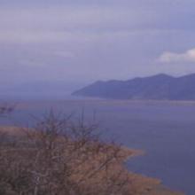


Lake Mikri Prespa
-
Country:Greece
-
Designation date:21-08-1975
-
Site number:60
-
Published since:26 year(s)
5,078 ha -
-

Salburua
-
Country:Spain
-
Designation date:24-10-2002
-
Site number:1263
-
Published since:21 year(s)
174 ha -
-

Lower Maruyama River and the Surrounding Rice Paddies
-
Country:Japan
-
Designation date:03-07-2012
-
Site number:2055
-
Published since:5 year(s)
1,094 ha -
-


Shizugawa-wan
-
Country:Japan
-
Designation date:18-10-2018
-
Site number:2358
-
Published since:5 year(s)
5,793 ha -
-


Manko
-
Country:Japan
-
Designation date:15-05-1999
-
Site number:996
-
Published since:7 year(s)
58 ha -
-

")


Salinas de Santa Pola
-
Country:Spain
-
Designation date:05-12-1989
-
Site number:457
-
Published since:3 year(s)
2,491 ha -
-


El Hondo
-
Country:Spain
-
Designation date:05-12-1989
-
Site number:455
-
Published since:3 year(s)
2,387 ha -
-


")
")
Parque Nacional Marítimo-Terrestre de las Islas Atlánticas de Galicia
-
Country:Spain
-
Designation date:22-05-2021
-
Site number:2453
-
Published since:2 year(s)
8,543 ha -