Search results
Search found 9 Ramsar Sites covering 550,077 ha
- (-) Remove Region/country: Europe filter Region/country: Europe
- (-) Remove Wetland type: Human-made wetlands filter Wetland type: Human-made wetlands
- (-) Remove Region/country: Ukraine filter Region/country: Ukraine
- (-) Remove Region/country: Italy filter Region/country: Italy
- (-) Remove Sites on Montreux record?: No filter Sites on Montreux record?: No
- (-) Remove Region/country: Israel filter Region/country: Israel
- (-) Remove Region/country: Sweden filter Region/country: Sweden
- (-) Remove Wetland type: 1: Aquaculture ponds filter Wetland type: 1: Aquaculture ponds
- (-) Remove Region/country: Armenia filter Region/country: Armenia
Map
Materials presented on this website, particularly maps and territorial information, are as-is and as-available based on available data and do not imply the expression of any opinion whatsoever on the part of the Secretariat of the Ramsar Convention concerning the legal status of any country, territory, city or area, or of its authorities, or concerning the delimitation of its frontiers or boundaries.
List
-


Laguna di Venezia: Valle Averto
-
Country:Italy
-
Designation date:11-04-1989
-
Site number:423
-
Published since:26 year(s)
500 ha -
-

Vincheto di Cellarda
-
Country:Italy
-
Designation date:14-12-1976
-
Site number:118
-
Published since:26 year(s)
99 ha -
-


Kugurlui Lake
-
Country:Ukraine
-
Designation date:28-02-1997
-
Site number:760
-
Published since:1 year(s)
13,493 ha -
-

-Sphagneta formations")

Perebrody Peatlands
-
Country:Ukraine
-
Designation date:17-11-2003
-
Site number:1402
-
Published since:7 year(s)
12,718 ha -
-


Prut River Headwaters
-
Country:Ukraine
-
Designation date:20-03-2019
-
Site number:2395
-
Published since:4 year(s)
4,935 ha -
-
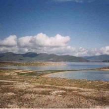


Lake Sevan
-
Country:Armenia
-
Designation date:07-06-1993
-
Site number:620
-
Published since:13 year(s)
490,231 ha -
-


Massaciuccoli lake and marsh
-
Country:Italy
-
Designation date:22-06-2017
-
Site number:2311
-
Published since:6 year(s)
11,135 ha -
-
Stagno di Cagliari
-
Country:Italy
-
Designation date:14-12-1976
-
Site number:134
-
Published since:16 year(s)
3,466 ha -
-
Valli residue del comprensorio di Comacchio
-
Country:Italy
-
Designation date:04-09-1981
-
Site number:225
-
Published since:26 year(s)
13,500 ha -