Search results
Search found 6 Ramsar Sites covering 505,051 ha
- (-) Remove Region/country: Serbia filter Region/country: Serbia
- (-) Remove Region/country: Azerbaijan filter Region/country: Azerbaijan
- (-) Remove Wetland type: Inland wetlands filter Wetland type: Inland wetlands
- (-) Remove Threats: Natural system modifications filter Threats: Natural system modifications
- (-) Remove Threats: Human settlements (non agricultural) filter Threats: Human settlements (non agricultural)
- (-) Remove Region/country: Armenia filter Region/country: Armenia
- (-) Remove Picture available?: Yes filter Picture available?: Yes
- (-) Remove Region/country: North America filter Region/country: North America
- (-) Remove Region/country: Portugal filter Region/country: Portugal
- (-) Remove Wetland type: U: Permanent Non-forested peatlands filter Wetland type: U: Permanent Non-forested peatlands
Map
Materials presented on this website, particularly maps and territorial information, are as-is and as-available based on available data and do not imply the expression of any opinion whatsoever on the part of the Secretariat of the Ramsar Convention concerning the legal status of any country, territory, city or area, or of its authorities, or concerning the delimitation of its frontiers or boundaries.
List
-

Door Peninsula Coastal Wetlands
-
Country:United States of America
-
Designation date:10-06-2014
-
Site number:2218
-
Published since:9 year(s)
4,631 ha -
-


 observada en enero de 2005 descansando en los humedales de la Popotera durante su migración.")
 es la especie que permanece mayor tiempo asoleándose sobre los pantanos y puede observarse fácilmente.")
 es la especie de tortuga dulceacuícola en mayor peligro de extinción en México, y estos humedales representan uno de sus últimos refugios en el estado de Veracruz.")
Humedales de la Laguna La Popotera
-
Country:Mexico
-
Designation date:05-06-2005
-
Site number:1462
-
Published since:18 year(s)
1,975 ha -
-

Chiwaukee Illinois Beach Lake Plain
-
Country:United States of America
-
Designation date:25-09-2015
-
Site number:2243
-
Published since:8 year(s)
1,584 ha -
-


")


")


Pestersko polje
-
Country:Serbia
-
Designation date:19-03-2006
-
Site number:1656
-
Published since:4 year(s)
3,421 ha -
-


")


Vlasina
-
Country:Serbia
-
Designation date:13-11-2007
-
Site number:1738
-
Published since:0 year(s)
3,209 ha -
-
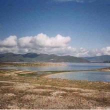


Lake Sevan
-
Country:Armenia
-
Designation date:07-06-1993
-
Site number:620
-
Published since:13 year(s)
490,231 ha -