Search results
Search found 27 Ramsar Sites covering 243,122 ha
- (-) Remove Region/country: Serbia filter Region/country: Serbia
- (-) Remove Region/country: Switzerland filter Region/country: Switzerland
- (-) Remove Picture available?: Yes filter Picture available?: Yes
- (-) Remove Region/country: Spain filter Region/country: Spain
Map
Materials presented on this website, particularly maps and territorial information, are as-is and as-available based on available data and do not imply the expression of any opinion whatsoever on the part of the Secretariat of the Ramsar Convention concerning the legal status of any country, territory, city or area, or of its authorities, or concerning the delimitation of its frontiers or boundaries.
List
-


Laubersmad-Salwidili
-
Country:Switzerland
-
Designation date:02-02-2005
-
Site number:1444
-
Published since:7 year(s)
1,376 ha -
-


Bolle di Magadino
-
Country:Switzerland
-
Designation date:18-02-1982
-
Site number:231
-
Published since:7 year(s)
663 ha -
-


Doñana
-
Country:Spain
-
Designation date:04-05-1982
-
Site number:234
-
Published since:17 year(s)
111,646 ha -
-


Kaltbrunner Riet
-
Country:Switzerland
-
Designation date:09-11-1990
-
Site number:509
-
Published since:7 year(s)
157 ha -
-

Salburua
-
Country:Spain
-
Designation date:24-10-2002
-
Site number:1263
-
Published since:21 year(s)
174 ha -
-


Les Grangettes
-
Country:Switzerland
-
Designation date:09-11-1990
-
Site number:504
-
Published since:5 year(s)
6,342 ha -
-

Klingnauer Stausee
-
Country:Switzerland
-
Designation date:09-11-1990
-
Site number:507
-
Published since:5 year(s)
364 ha -
-


 and Roseg (right) glaciers.")

Vadret da Roseg
-
Country:Switzerland
-
Designation date:02-02-2005
-
Site number:1446
-
Published since:5 year(s)
383 ha -
-

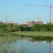
")


Salinas de Santa Pola
-
Country:Spain
-
Designation date:05-12-1989
-
Site number:457
-
Published since:3 year(s)
2,491 ha -
-


El Hondo
-
Country:Spain
-
Designation date:05-12-1989
-
Site number:455
-
Published since:3 year(s)
2,387 ha -