Search results
Search found 12 Ramsar Sites covering 143,493 ha
- (-) Remove Region/country: Serbia filter Region/country: Serbia
- (-) Remove Max elevation (in meters): 0 - 499 filter Max elevation (in meters): 0 - 499
- (-) Remove Region/country: Austria filter Region/country: Austria
- (-) Remove Region/country: Portugal filter Region/country: Portugal
- (-) Remove Ramsar criteria: 2 filter Ramsar criteria: 2
- (-) Remove Region/country: Luxembourg filter Region/country: Luxembourg
- (-) Remove Region/country: Hungary filter Region/country: Hungary
- (-) Remove Ramsar criteria: 7 filter Ramsar criteria: 7
Map
Materials presented on this website, particularly maps and territorial information, are as-is and as-available based on available data and do not imply the expression of any opinion whatsoever on the part of the Secretariat of the Ramsar Convention concerning the legal status of any country, territory, city or area, or of its authorities, or concerning the delimitation of its frontiers or boundaries.
List
-

Donau-March-Thaya-Auen
-
Country:Austria
-
Designation date:16-12-1982
-
Site number:272
-
Published since:16 year(s)
36,090 ha -
-

Rába valley
-
Country:Hungary
-
Designation date:06-10-2006
-
Site number:1645
-
Published since:7 year(s)
9,552 ha -
-

Upper Tisza (Felsö-Tisza)
-
Country:Hungary
-
Designation date:10-01-2004
-
Site number:1410
-
Published since:7 year(s)
26,871 ha -
-

Kis-Balaton
-
Country:Hungary
-
Designation date:11-04-1979
-
Site number:185
-
Published since:7 year(s)
14,659 ha -
-


Fishponds and Marshlands south of Lake Balaton
-
Country:Hungary
-
Designation date:09-06-2011
-
Site number:1963
-
Published since:5 year(s)
9,483 ha -
-

Lake Kolon at Izsák
-
Country:Hungary
-
Designation date:30-04-1997
-
Site number:902
-
Published since:8 year(s)
3,059 ha -
-
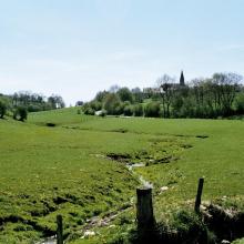

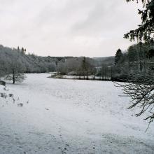

Vallée de la Haute-Sûre
-
Country:Luxembourg
-
Designation date:08-03-2004
-
Site number:1408
-
Published since:21 year(s)
16,900 ha -
-
'Fajãs' of Caldeira and Cubres Lagoons
-
Country:Portugal
-
Designation date:02-12-2005
-
Site number:1615
-
Published since:18 year(s)
87 ha -
-
Bertiandos and S. Pedro of Arcos Lagoons
-
Country:Portugal
-
Designation date:02-12-2005
-
Site number:1613
-
Published since:18 year(s)
346 ha -
-
Paúl do Taipal
-
Country:Portugal
-
Designation date:17-10-2001
-
Site number:1107
-
Published since:22 year(s)
233 ha -