Search results
Search found 29 Ramsar Sites covering 601,916 ha
- (-) Remove Region/country: Europe filter Region/country: Europe
- (-) Remove Wetland type: Human-made wetlands filter Wetland type: Human-made wetlands
- (-) Remove Region/country: Bosnia and Herzegovina filter Region/country: Bosnia and Herzegovina
- (-) Remove Region/country: Switzerland filter Region/country: Switzerland
- (-) Remove Region/country: Armenia filter Region/country: Armenia
- (-) Remove Threats: Pollution filter Threats: Pollution
- (-) Remove Ramsar criteria: 4 filter Ramsar criteria: 4
- (-) Remove Region/country: Italy filter Region/country: Italy
Map
Materials presented on this website, particularly maps and territorial information, are as-is and as-available based on available data and do not imply the expression of any opinion whatsoever on the part of the Secretariat of the Ramsar Convention concerning the legal status of any country, territory, city or area, or of its authorities, or concerning the delimitation of its frontiers or boundaries.
List
-
")
,on the left, the old tower of Nubia and the Egadi island on the background")
")
")
, an old mill on the background and Favignana Island")
")
")
")
")
")
")
Trapani and Paceco salt ponds
-
Country:Italy
-
Designation date:19-10-2017
-
Site number:2329
-
Published since:6 year(s)
971 ha -
-


Busatello marsh
-
Country:Italy
-
Designation date:03-10-2017
-
Site number:2315
-
Published since:6 year(s)
443 ha -
-


Massaciuccoli lake and marsh
-
Country:Italy
-
Designation date:22-06-2017
-
Site number:2311
-
Published since:6 year(s)
11,135 ha -
-
 of 230 km2
Figure 1
Route: Lusnic – Celebic – Donji Kazanci")


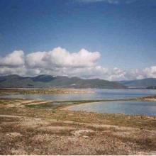
Livanjsko Polje
-
Country:Bosnia and Herzegovina
-
Designation date:11-04-2008
-
Site number:1786
-
Published since:16 year(s)
45,868 ha -
-

Bardaca Wetland
-
Country:Bosnia and Herzegovina
-
Designation date:02-02-2007
-
Site number:1658
-
Published since:17 year(s)
3,500 ha -
-


Khor Virap Marsh
-
Country:Armenia
-
Designation date:25-01-2007
-
Site number:1989
-
Published since:13 year(s)
50 ha -
-

Oasis of the Sele - Serre Persano
-
Country:Italy
-
Designation date:07-08-2003
-
Site number:1665
-
Published since:1 year(s)
174 ha -
-


Hutovo Blato
-
Country:Bosnia and Herzegovina
-
Designation date:24-09-2001
-
Site number:1105
-
Published since:4 year(s)
7,824 ha -
-


Lake Sevan
-
Country:Armenia
-
Designation date:07-06-1993
-
Site number:620
-
Published since:13 year(s)
490,231 ha -
-
Lake Arpi
-
Country:Armenia
-
Designation date:07-06-1993
-
Site number:621
-
Published since:13 year(s)
3,230 ha -