Search results
Search found 20 Ramsar Sites covering 222,262 ha
- (-) Remove Wetland type: Inland wetlands filter Wetland type: Inland wetlands
- (-) Remove Region/country: Switzerland filter Region/country: Switzerland
- (-) Remove Region/country: Latvia filter Region/country: Latvia
- (-) Remove Ecosystem services: Cultural Services filter Ecosystem services: Cultural Services
- (-) Remove Region/country: Bosnia and Herzegovina filter Region/country: Bosnia and Herzegovina
Map
Materials presented on this website, particularly maps and territorial information, are as-is and as-available based on available data and do not imply the expression of any opinion whatsoever on the part of the Secretariat of the Ramsar Convention concerning the legal status of any country, territory, city or area, or of its authorities, or concerning the delimitation of its frontiers or boundaries.
List
-
 of 230 km2
Figure 1
Route: Lusnic – Celebic – Donji Kazanci")


Livanjsko Polje
-
Country:Bosnia and Herzegovina
-
Designation date:11-04-2008
-
Site number:1786
-
Published since:16 year(s)
45,868 ha -
-

Bardaca Wetland
-
Country:Bosnia and Herzegovina
-
Designation date:02-02-2007
-
Site number:1658
-
Published since:17 year(s)
3,500 ha -
-


Rhonegletschervorfeld
-
Country:Switzerland
-
Designation date:02-02-2005
-
Site number:1445
-
Published since:7 year(s)
317 ha -
-


 and Roseg (right) glaciers.")

Vadret da Roseg
-
Country:Switzerland
-
Designation date:02-02-2005
-
Site number:1446
-
Published since:5 year(s)
383 ha -
-


Laubersmad-Salwidili
-
Country:Switzerland
-
Designation date:02-02-2005
-
Site number:1444
-
Published since:7 year(s)
1,376 ha -
-
Pape Wetland Complex
-
Country:Latvia
-
Designation date:27-03-2003
-
Site number:1386
-
Published since:21 year(s)
51,725 ha -
-


Lubana wetland complex
-
Country:Latvia
-
Designation date:27-03-2003
-
Site number:1384
-
Published since:21 year(s)
48,020 ha -
-
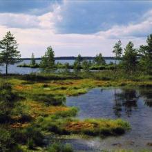
Northern Bogs
-
Country:Latvia
-
Designation date:27-03-2003
-
Site number:1385
-
Published since:21 year(s)
5,318 ha -
-


Hutovo Blato
-
Country:Bosnia and Herzegovina
-
Designation date:24-09-2001
-
Site number:1105
-
Published since:4 year(s)
7,824 ha -
-


Lake Engure
-
Country:Latvia
-
Designation date:25-07-1995
-
Site number:738
-
Published since:0 year(s)
19,762 ha -