Search results
Search found 117 Ramsar Sites covering 28,325,506 ha
- (-) Remove Region/country: Serbia filter Region/country: Serbia
- (-) Remove Region/country: Israel filter Region/country: Israel
- (-) Remove Region/country: Armenia filter Region/country: Armenia
- (-) Remove Region/country: Ukraine filter Region/country: Ukraine
- (-) Remove Region/country: Belgium filter Region/country: Belgium
- (-) Remove Region/country: Latin America and the Caribbean filter Region/country: Latin America and the Caribbean
- (-) Remove Picture available?: Yes filter Picture available?: Yes
- (-) Remove Region/country: Latvia filter Region/country: Latvia
Map
Materials presented on this website, particularly maps and territorial information, are as-is and as-available based on available data and do not imply the expression of any opinion whatsoever on the part of the Secretariat of the Ramsar Convention concerning the legal status of any country, territory, city or area, or of its authorities, or concerning the delimitation of its frontiers or boundaries.
List
-


Kyliiske Mouth
-
Country:Ukraine
-
Designation date:11-10-1976
-
Site number:113
-
Published since:1 year(s)
44,904 ha -
-


Karkinitska and Dzharylgatska Bays
-
Country:Ukraine
-
Designation date:11-10-1976
-
Site number:114
-
Published since:1 year(s)
147,557 ha -
-


Yagorlytska Bay
-
Country:Ukraine
-
Designation date:28-02-1997
-
Site number:116
-
Published since:1 year(s)
39,693 ha -
-


Marais d'Harchies
-
Country:Belgium
-
Designation date:04-03-1986
-
Site number:331
-
Published since:9 year(s)
557 ha -
-
")
")

Reserva Nacional de Paracas
-
Country:Peru
-
Designation date:30-03-1992
-
Site number:545
-
Published since:2 year(s)
335,000 ha -
-


Parque Nacional Río Pilcomayo
-
Country:Argentina
-
Designation date:04-05-1992
-
Site number:557
-
Published since:2 year(s)
51,889 ha -
-

Parque Nacional del Pantanal Matogrosense
-
Country:Brazil
-
Designation date:24-05-1993
-
Site number:602
-
Published since:4 year(s)
135,000 ha -
-
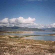


Lake Sevan
-
Country:Armenia
-
Designation date:07-06-1993
-
Site number:620
-
Published since:13 year(s)
490,231 ha -
-

Reentrancias Maranhenses
-
Country:Brazil
-
Designation date:30-11-1993
-
Site number:640
-
Published since:2 year(s)
2,680,911 ha -
-


Parque Nacional Jeanette Kawas
-
Country:Honduras
-
Designation date:28-03-1995
-
Site number:722
-
Published since:2 year(s)
79,382 ha -