Search results
Search found 60 Ramsar Sites covering 18,807,827 ha
- (-) Remove Threats: Transportation and service corridors filter Threats: Transportation and service corridors
- (-) Remove Management plan available: No filter Management plan available: No
- (-) Remove Ramsar criteria: 1 filter Ramsar criteria: 1
- (-) Remove Picture available?: Yes filter Picture available?: Yes
- (-) Remove Wetland type: Human-made wetlands filter Wetland type: Human-made wetlands
- (-) Remove Ecosystem services: Regulating Services filter Ecosystem services: Regulating Services
- (-) Remove Threats: Unspecified filter Threats: Unspecified
- (-) Remove Threats: Human settlements (non agricultural) filter Threats: Human settlements (non agricultural)
- (-) Remove Sites on Montreux record?: No filter Sites on Montreux record?: No
Map
Materials presented on this website, particularly maps and territorial information, are as-is and as-available based on available data and do not imply the expression of any opinion whatsoever on the part of the Secretariat of the Ramsar Convention concerning the legal status of any country, territory, city or area, or of its authorities, or concerning the delimitation of its frontiers or boundaries.
List
-


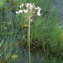
Oued Tizguite
-
Country:Morocco
-
Designation date:16-04-2019
-
Site number:2375
-
Published since:4 year(s)
606 ha -
-


Nanthar Island and Mayyu Estuary
-
Country:Myanmar
-
Designation date:22-05-2020
-
Site number:2421
-
Published since:4 year(s)
3,608 ha -
-


Indawgyi Wildlife Sanctuary
-
Country:Myanmar
-
Designation date:02-02-2016
-
Site number:2256
-
Published since:8 year(s)
47,884 ha -
-


Inlay Lake Ramsar Site
-
Country:Myanmar
-
Designation date:10-08-2018
-
Site number:2356
-
Published since:5 year(s)
5,798 ha -
-

Malpais/Sint Michiel
-
Country:Netherlands (Kingdom of the) (Curaçao)
-
Designation date:05-02-2013
-
Site number:2117
-
Published since:11 year(s)
1,100 ha -
-


Wetlands Reserve in Al Wusta Governorate
-
Country:Oman
-
Designation date:25-10-2023
-
Site number:2529
-
Published since:0 year(s)
213,715 ha -
-


Bahía de Panamá
-
Country:Panama
-
Designation date:20-10-2003
-
Site number:1319
-
Published since:4 year(s)
85,665 ha -
-


Swidwie Lake Nature Reserve
-
Country:Poland
-
Designation date:03-01-1984
-
Site number:283
-
Published since:5 year(s)
891 ha -
-


Kalissaye
-
Country:Senegal
-
Designation date:01-09-2017
-
Site number:2326
-
Published since:6 year(s)
30,014 ha -
-

Tisa River
-
Country:Slovakia
-
Designation date:04-12-2004
-
Site number:1411
-
Published since:19 year(s)
735 ha -