Search results
Search found 276 Ramsar Sites covering 14,147,437 ha
- (-) Remove Wetland type: Inland wetlands filter Wetland type: Inland wetlands
- (-) Remove Wetland type: U: Permanent Non-forested peatlands filter Wetland type: U: Permanent Non-forested peatlands
- (-) Remove Wetland type: Zg: Geothermal wetlands filter Wetland type: Zg: Geothermal wetlands
- (-) Remove Picture available?: Yes filter Picture available?: Yes
Map
Materials presented on this website, particularly maps and territorial information, are as-is and as-available based on available data and do not imply the expression of any opinion whatsoever on the part of the Secretariat of the Ramsar Convention concerning the legal status of any country, territory, city or area, or of its authorities, or concerning the delimitation of its frontiers or boundaries.
List
-
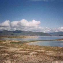


Lake Sevan
-
Country:Armenia
-
Designation date:07-06-1993
-
Site number:620
-
Published since:13 year(s)
490,231 ha -
-

Lätäseno-Hietajoki Mires
-
Country:Finland
-
Designation date:02-02-2004
-
Site number:1520
-
Published since:1 year(s)
43,367 ha -
-


Laubersmad-Salwidili
-
Country:Switzerland
-
Designation date:02-02-2005
-
Site number:1444
-
Published since:7 year(s)
1,376 ha -
-

Lavinia Nature Reserve
-
Country:Australia
-
Designation date:16-11-1982
-
Site number:253
-
Published since:10 year(s)
7,034 ha -
-


Le Cirque de Aïn Ouarka
-
Country:Algeria
-
Designation date:06-04-2003
-
Site number:1300
-
Published since:3 year(s)
2,350 ha -
-


Leidissoo
-
Country:Estonia
-
Designation date:27-01-2010
-
Site number:1998
-
Published since:4 year(s)
8,178 ha -
-


 en pleine activités")
")
")
Le Lac Alaotra : Les Zones Humides et Bassins Versants
-
Country:Madagascar
-
Designation date:09-09-2003
-
Site number:1312
-
Published since:7 year(s)
722,500 ha -
-


Le Marais audomarois
-
Country:France
-
Designation date:15-09-2008
-
Site number:1835
-
Published since:6 year(s)
3,726 ha -
-

Lemmenjoki National Park
-
Country:Finland
-
Designation date:02-02-2004
-
Site number:1521
-
Published since:1 year(s)
285,990 ha -
-


Le Pinail
-
Country:France
-
Designation date:22-10-2021
-
Site number:2461
-
Published since:2 year(s)
923 ha -