Search results
Search found 496 Ramsar Sites covering 99,507,528 ha
- (-) Remove Wetland type: Inland wetlands filter Wetland type: Inland wetlands
- (-) Remove Ecosystem services: Provisioning Services filter Ecosystem services: Provisioning Services
- (-) Remove Wetland type: W: Shrub-dominated wetlands filter Wetland type: W: Shrub-dominated wetlands
- (-) Remove Wetland type: P: Seasonal/ intermittent freshwater lakes filter Wetland type: P: Seasonal/ intermittent freshwater lakes
Map
Materials presented on this website, particularly maps and territorial information, are as-is and as-available based on available data and do not imply the expression of any opinion whatsoever on the part of the Secretariat of the Ramsar Convention concerning the legal status of any country, territory, city or area, or of its authorities, or concerning the delimitation of its frontiers or boundaries.
List
-
 et le Fanel (à droit du canal) avec les zones humides et la lagune.")
 .")
Fanel et Chablais de Cudrefin
-
Country:Switzerland
-
Designation date:16-01-1976
-
Site number:79
-
Published since:7 year(s)
1,155 ha -
-


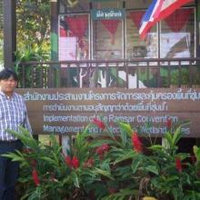
Khao Sam Roi Yot Wetland
-
Country:Thailand
-
Designation date:08-01-2008
-
Site number:2238
-
Published since:8 year(s)
6,892 ha -
-

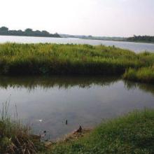
Kut Ting Marshland
-
Country:Thailand
-
Designation date:19-06-2009
-
Site number:1926
-
Published since:15 year(s)
2,200 ha -
-
Bung Khong Long Non-Hunting Area
-
Country:Thailand
-
Designation date:05-07-2001
-
Site number:1098
-
Published since:23 year(s)
2,214 ha -
-

Nong Bong Kai Non-Hunting Area
-
Country:Thailand
-
Designation date:05-07-2001
-
Site number:1101
-
Published since:23 year(s)
434 ha -
-
Princess Sirindhorn Wildlife Sanctuary
-
Country:Thailand
-
Designation date:05-07-2001
-
Site number:1102
-
Published since:23 year(s)
20,100 ha -
-
Garaet Sidi Mansour
-
Country:Tunisia
-
Designation date:07-11-2007
-
Site number:1703
-
Published since:16 year(s)
2,426 ha -
-
Marais d'eau douce Garaet Douza
-
Country:Tunisia
-
Designation date:02-02-2012
-
Site number:2007
-
Published since:12 year(s)
1,400 ha -
-
Lake Mburo-Nakivali Wetland System
-
Country:Uganda
-
Designation date:15-09-2006
-
Site number:1634
-
Published since:17 year(s)
26,834 ha -
-


Lutembe Bay Wetland System
-
Country:Uganda
-
Designation date:15-09-2006
-
Site number:1637
-
Published since:17 year(s)
98 ha -