Search results
Search found 289 Ramsar Sites covering 19,089,361 ha
- (-) Remove Wetland type: Inland wetlands filter Wetland type: Inland wetlands
- (-) Remove Threats: Natural system modifications filter Threats: Natural system modifications
- (-) Remove Threats: Human settlements (non agricultural) filter Threats: Human settlements (non agricultural)
- (-) Remove Threats: Unspecified/others filter Threats: Unspecified/others
- (-) Remove Threats: Pollution filter Threats: Pollution
- (-) Remove Management plan available: In preparation filter Management plan available: In preparation
Map
Materials presented on this website, particularly maps and territorial information, are as-is and as-available based on available data and do not imply the expression of any opinion whatsoever on the part of the Secretariat of the Ramsar Convention concerning the legal status of any country, territory, city or area, or of its authorities, or concerning the delimitation of its frontiers or boundaries.
List
-

Partie Camerounaise du Lac Tchad
-
Country:Cameroon
-
Designation date:02-02-2010
-
Site number:1903
-
Published since:14 year(s)
12,500 ha -
-

Baradla Cave System and related wetlands
-
Country:Hungary
-
Designation date:14-08-2001
-
Site number:1092
-
Published since:7 year(s)
2,056 ha -
-

Biharugra Fishponds
-
Country:Hungary
-
Designation date:26-05-1997
-
Site number:903
-
Published since:7 year(s)
2,791 ha -
-

Vassorfjärden Bay
-
Country:Finland
-
Designation date:02-02-2004
-
Site number:1538
-
Published since:0 year(s)
1,537 ha -
-
Caddo Lake
-
Country:United States of America
-
Designation date:23-10-1993
-
Site number:633
-
Published since:17 year(s)
7,977 ha -
-
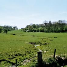


Vallée de la Haute-Sûre
-
Country:Luxembourg
-
Designation date:08-03-2004
-
Site number:1408
-
Published since:21 year(s)
16,900 ha -
-
Sultan Marshes
-
Country:Türkiye
-
Designation date:13-07-1994
-
Site number:661
-
Published since:16 year(s)
17,200 ha -
-
Colne Estuary
-
Country:United Kingdom of Great Britain and Northern Ireland
-
Designation date:28-07-1994
-
Site number:665
-
Published since:25 year(s)
2,701 ha -
-

Hortobágy
-
Country:Hungary
-
Designation date:11-04-1979
-
Site number:189
-
Published since:7 year(s)
32,037 ha -
-


")


")
")

Yoshigadaira Wetlands
-
Country:Japan
-
Designation date:28-05-2015
-
Site number:2233
-
Published since:8 year(s)
887 ha -