


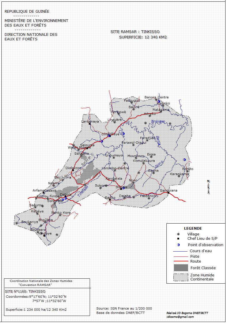
Tinkisso
- Country:Guinea
- Site number:1168
- Area:1,228,995.3 ha
- Designation date:17-01-2002
- Coordinates:11°02'N 10°39'W
Materials presented on this website, particularly maps and territorial information, are as-is and as-available based on available data and do not imply the expression of any opinion whatsoever on the part of the Secretariat of the Ramsar Convention concerning the legal status of any country, territory, city or area, or of its authorities, or concerning the delimitation of its frontiers or boundaries.
Overview
The Tinkisso Ramsar Site covers over 12,000 square kilometres of the upper reaches of the Tinkisso River, which flows from the highlands near Dabola and Dinguiraye downstream toward the plains near Siguiri. Its climate is characterized by two seasons, rainy from June to October and dry from November to May ,with a strong dry easterly wind called the harmattan. The Site supports water birds such as the spur-winged goose (Plectropterus gambensis), the white-faced whistling duck (Dendrocygna viduata), the cattle egret (Bubulcus ibis), the little egret (Egretta garzetta) and the African jacana (Actophilornis africanus). Extensive farming, prohibited fishing practices, and gold panning are major threats to the Site. The rhun palm (Borassus aethiopum) has been seriously over-exploited, particularly for making palm wine, and will disappear in the region unless steps are taken. A range of legislative texts have been adopted to strengthen measures to protect natural resources.
Administrative region:
Préf. de Dabola,Préf. de Dinguiraye,Préf. de Kouro
- National legal designation:
- Réserve naturelle gérée
- Last publication date:28-03-2017
Downloads
Ramsar Information Sheet (RIS)
Archived RIS
Site map
Additional reports and documents
- Other published literature