Maidika
Maidika
- Country:
- China
- Site number:
- 1438
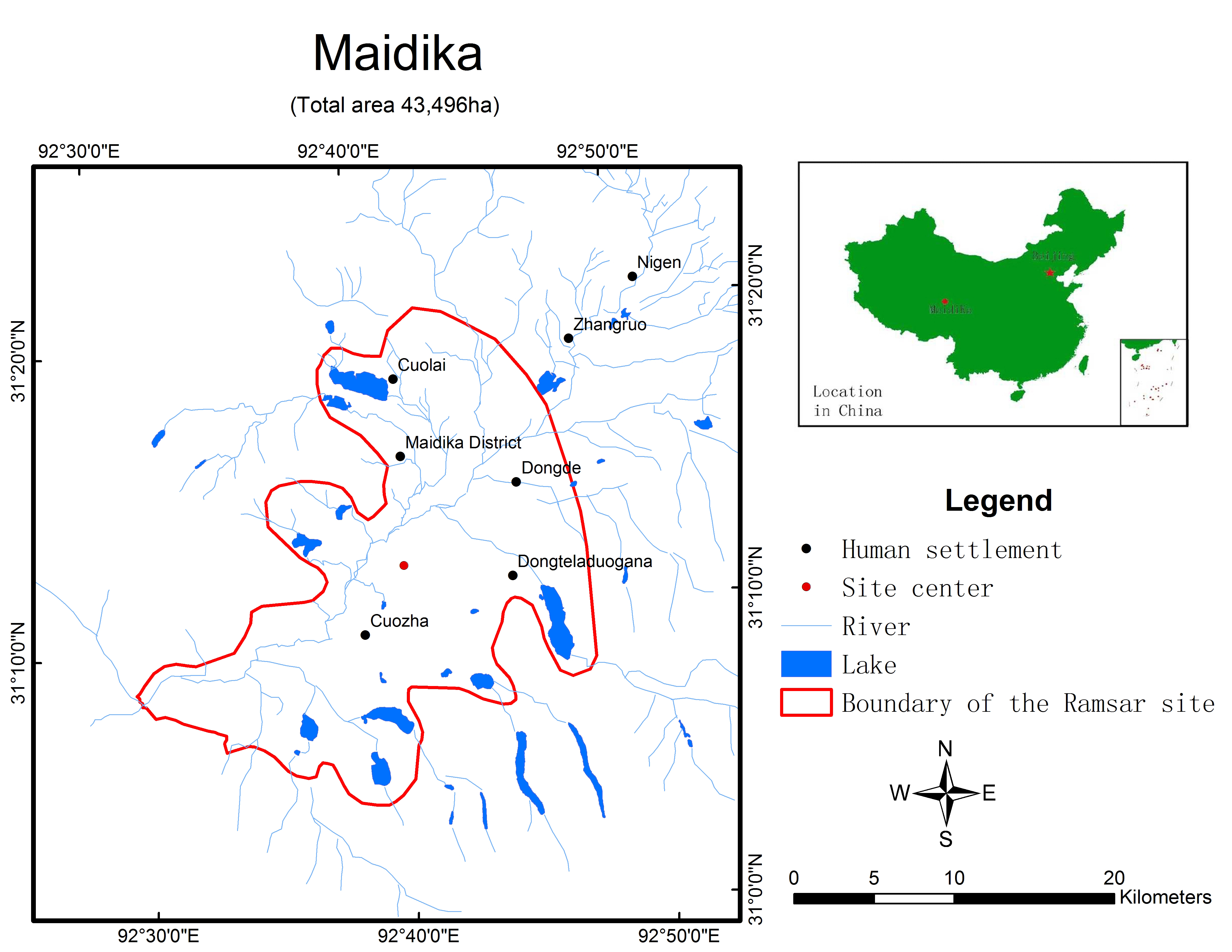
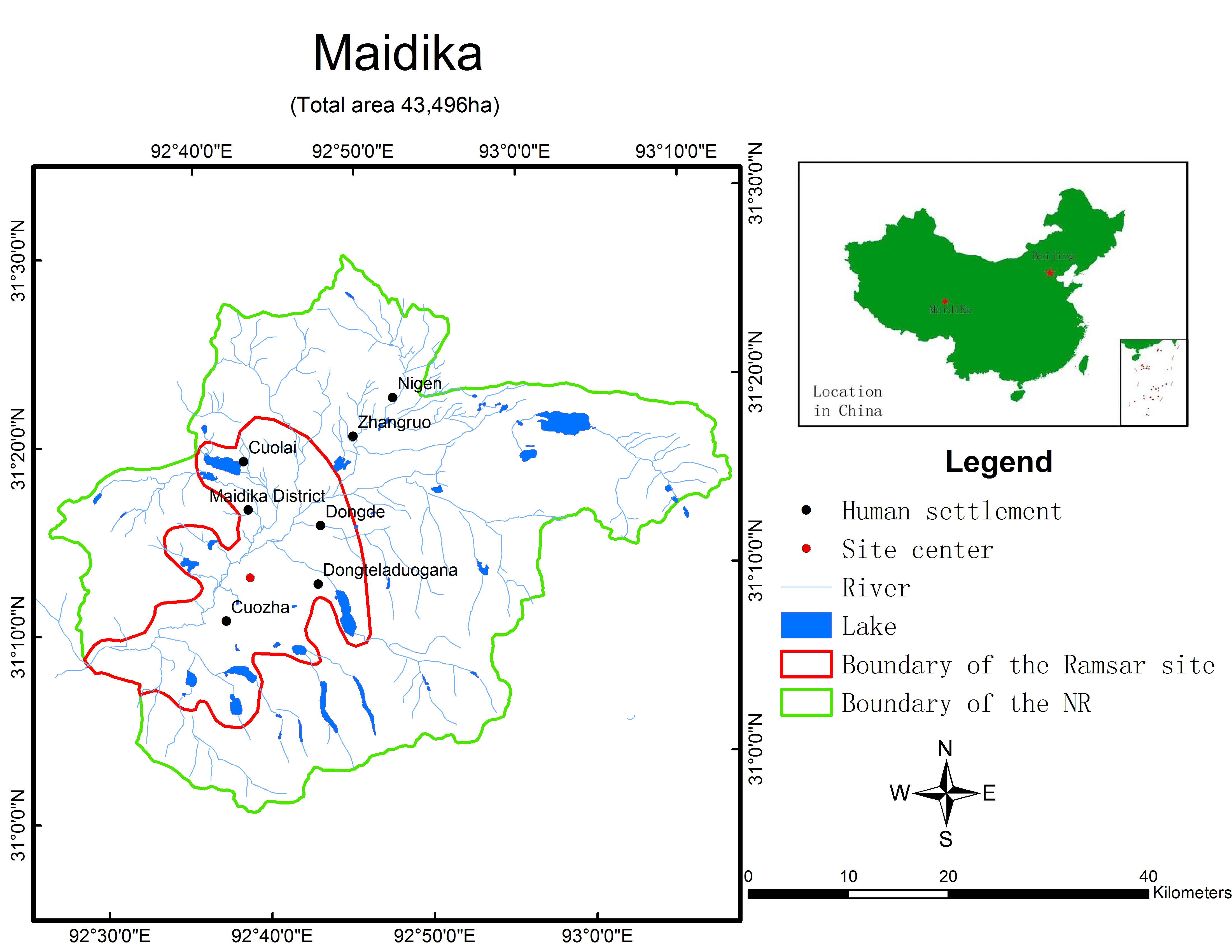
- Area:
- 43,496.0 ha
- Designation date:
- 01-12-2004
- Coordinates:
- 31°01'N 92°50'55"E
Carousel
Carousel


Materials presented on this website, particularly maps and territorial information, are as-is and as-available based on available data and do not imply the expression of any opinion whatsoever on the part of the Secretariat of the Ramsar Convention concerning the legal status of any country, territory, city or area, or of its authorities, or concerning the delimitation of its frontiers or boundaries.
This vast swamp meadow is located on the Qinghai-Tibet Plateau at 4,800 metres above sea level. With permanent and seasonal pools and lakes, the wetland forms one of the sources of the Lhasa River. It is one of the highest altitude wetlands in China and indeed the world, performing major hydrological functions such as control of soil erosion and prevention of seasonal floods. Maidika also has an important role in providing water for residents as well as acting to retain sediment and sequester carbon. The wetland plays a critical role as a staging and breeding habitat for migratory waterfowl, including the vulnerable black-necked crane (Grus nigricollis) and the common pochard (Aythya ferina). The endangered snow leopard (Panthera uncia) and the endangered saker falcon (Falco cherrug) can also be found within the site. Over-grazing and reduced rainfall as a result of climate change are present threats to the ecological character. The lands are state-owned and are managed by the Bureau of Maidika Wetland in Chali County.
- National Nature Reserve - Tibet Maidika National Nature Reserve
- CN1438RIS_2007_en.pdf