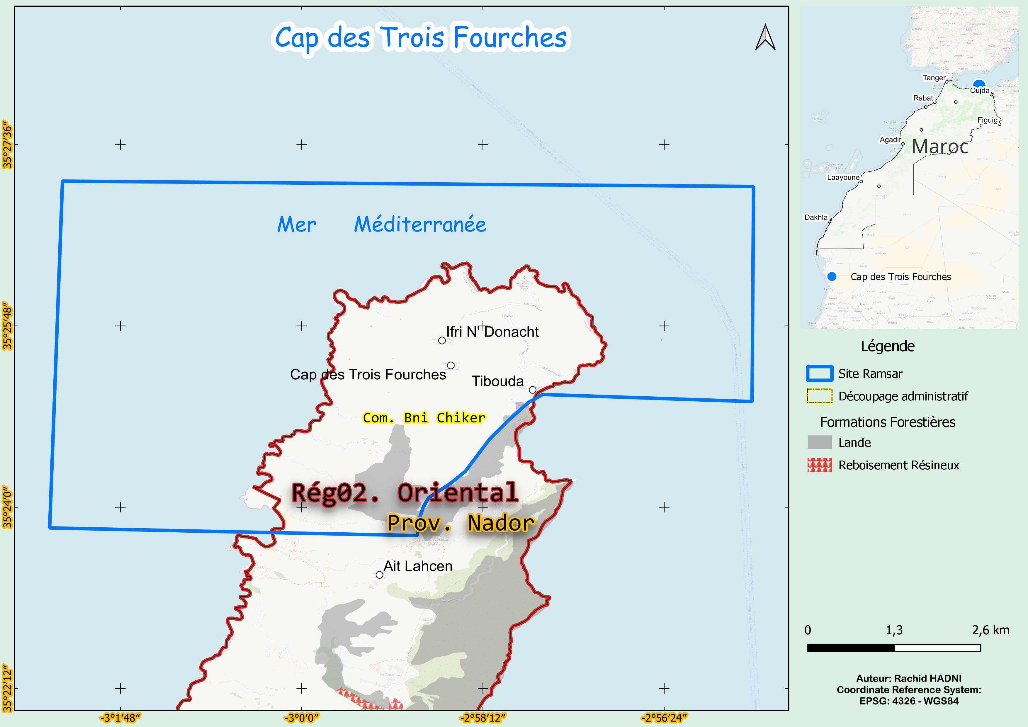
Cap des Trois Fourches
Cap des Trois Fourches
- Country:
- Morocco
- Site number:
- 1473
- Area:
- 5,640.0 ha
- Designation date:
- 15-01-2005
- Coordinates:
- 35°25'41"N 02°59'21"W
Carousel
Carousel


Materials presented on this website, particularly maps and territorial information, are as-is and as-available based on available data and do not imply the expression of any opinion whatsoever on the part of the Secretariat of the Ramsar Convention concerning the legal status of any country, territory, city or area, or of its authorities, or concerning the delimitation of its frontiers or boundaries.
The Site is situated on the Mediterranean Sea at the eastern edge of the Rif Mountains, about 30 kilometres north of the city of Nador. It is known for its volcanic geology that influences the chemical environment of the coastal waters, fostering rich biodiversity. The Site supports threatened species such as the globally vulnerable loggerhead turtle (Caretta caretta), fin whale (Balaenoptera physalus) and Mediterranean monk seal (Monachus monachus). It also provides vital habitats for fish such as the black limpet (Cymbula nigra) and dusky grouper (Epinephelus marginatus), along with waterbirds such as the storm petrel (Hydrobates pelagicus) and Audouin’s gull (Ichthyaetus audouinii), the latter being protected under CMS Appendix I. The wetlands here offer critical ecosystem services, including groundwater recharge, water storage and water supply for agriculture and industry. The Site is also used for recreational fishing and hunting, and is valued for its cultural heritage and as a centre for scientific research.
- Site of Biological and Ecological Interest
- MA1473RIS_2501_fr.pdf
- MA1473RISformer_220824.pdf
- MA1473_map230721.jpg