Embouchure de l'oued Dr'a
Embouchure de l'oued Dr'a
- Country:
- Morocco
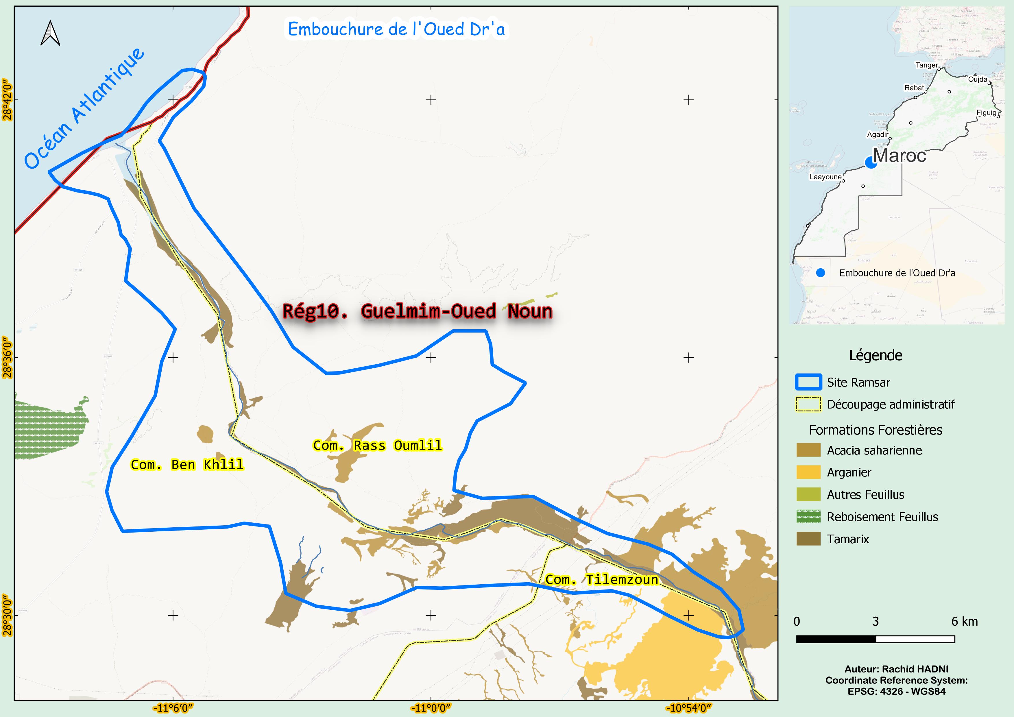
- Site number:
- 1477
- Area:
- 19,110.0 ha
- Designation date:
- 15-01-2005
- Coordinates:
- 28°34'18"N 11°02'20"W
Carousel
Carousel


Materials presented on this website, particularly maps and territorial information, are as-is and as-available based on available data and do not imply the expression of any opinion whatsoever on the part of the Secretariat of the Ramsar Convention concerning the legal status of any country, territory, city or area, or of its authorities, or concerning the delimitation of its frontiers or boundaries.
The Site lies at the northern edge of the Western Sahara where Oued Dr'a, Morocco’s largest Atlantic wadi, flows into the ocean. Draining vast areas of the Grand Atlas and Anti-Atlas Mountains, it forms a wide, steep-sided corridor with a sandy bottom. The channel meanders through small dunes covered with bushy vegetation before entering a steep valley bordered by high cliffs and opening into the coastal plateau. The Site also includes coastal waters, cliffs, and a sandy beach north of the wadi. It offers critical habitat for vulnerable species, including the houbara bustard (Chlamydotis undulata), Audouin’s gull (Ichthyaetus audouinii) and marbled teal (Marmaronetta angustirostris). Beyond its ecological value, the area supports local livelihoods through fishing and tourism. However, habitat degradation and human disturbance pose growing threats. Strengthening conservation measures is essential to preserving biodiversity and ensuring long-term sustainability.
- Site of Biological and Ecological Interest
- MA1477RIS_2503_fr.pdf
- MA1477RISformer_220826.pdf
- MA1477_map230605.jpg
- MA1477_taxo161007.docx