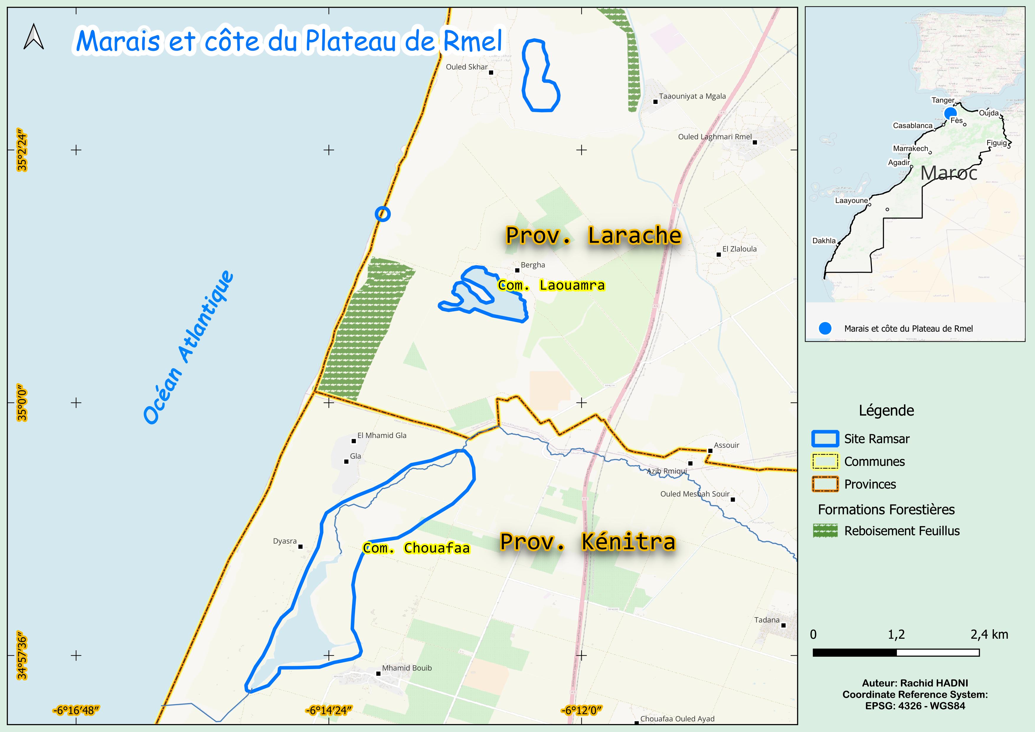
Marais et côte du Plateau de Rmel
Marais et côte du Plateau de Rmel
- Country:
- Morocco
- Site number:
- 1481
- Area:
- 600.0 ha
- Designation date:
- 15-01-2005
- Coordinates:
- 34°59'08"N 06°13'51"W
Carousel
Carousel

Materials presented on this website, particularly maps and territorial information, are as-is and as-available based on available data and do not imply the expression of any opinion whatsoever on the part of the Secretariat of the Ramsar Convention concerning the legal status of any country, territory, city or area, or of its authorities, or concerning the delimitation of its frontiers or boundaries.
This Site features diverse ecosystems, including three freshwater coastal lakes, a sandy beach, inter-dunal marshes and irrigated areas. It provides critical habitat for threatened species such as the marbled teal (Marmaronetta angustirostris) and European eel (Anguilla anguilla), along with endemic reptiles and amphibians. The Site is a key wintering area for the lesser black-backed gull (Larus fuscus), supporting over 1% of its biogeographical population. Beyond its value for migratory birds, it sustains a variety of wildlife. However, agricultural activities pose significant threats, including groundwater depletion, reduced river flows, and eutrophication. Pollution from pesticides and fertilizers further endangers its ecological balance, underscoring the urgent need for conservation and sustainable management to protect its biodiversity.
- Site of Biological and Ecological Interest
- MA1481RIS_2503_fr.pdf
- MA1481RISformer_220826.pdf
- MA1481_map240604.jpg
- MA1481_taxo161006.docx