Merja Zerga
Merja Zerga
- Country:
- Morocco
- Site number:
- 206
- Area:
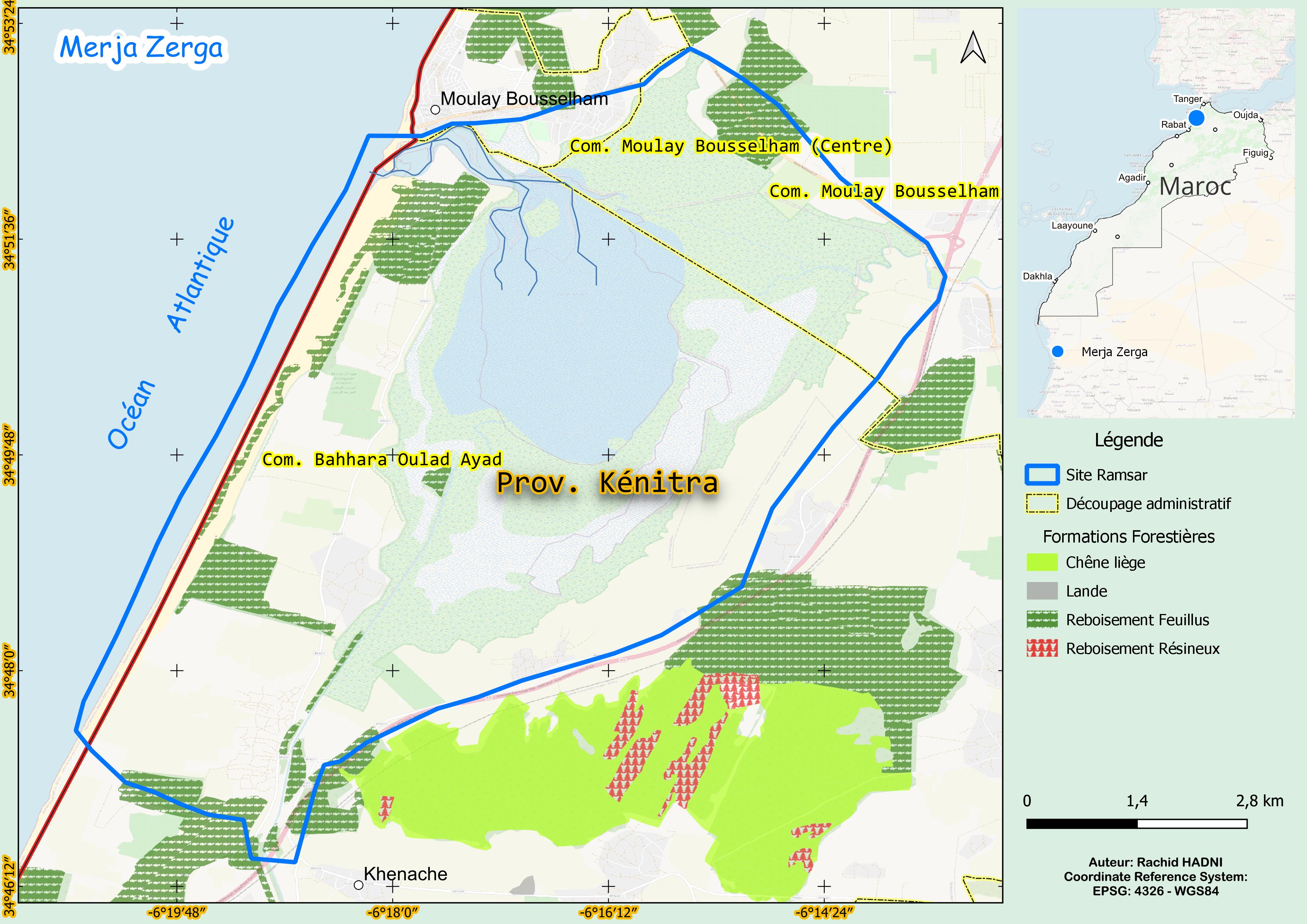
- 7,300.0 ha
- Designation date:
- 20-06-1980
- Coordinates:
- 34°49'59"N 06°17'05"W
Carousel
Carousel

Materials presented on this website, particularly maps and territorial information, are as-is and as-available based on available data and do not imply the expression of any opinion whatsoever on the part of the Secretariat of the Ramsar Convention concerning the legal status of any country, territory, city or area, or of its authorities, or concerning the delimitation of its frontiers or boundaries.
The Merja Zerga is a large coastal lagoon formed in a depression between sand dunes, separated from the Atlantic Ocean by a quaternary sandstone bar covered with loose dune sand. A break at its northern edge creates a wide channel that connects it directly to the ocean. The lagoon spans nine kilometres in length and 5 km in width, covering about 40 km², with depths exceeding two metres in the channel. It is a key economic resource, supporting traditional fishing and expanding agriculture. It also provides critical habitat for threatened species such as the Moroccan spadefoot toad (Pelobates varaldii) and European eel (Anguilla anguilla). Since 1951, residents have had fishing rights, though oversight remains with local authorities rather than the national forestry administration. Nonetheless, increasing irrigation, excessive water extraction, and pesticide use threaten its ecological balance. Additional pressures include poaching, egg collection, and harvesting of rushes. Uncontrolled habitat degradation underscores the urgent need for sustainable management to balance economic development with conservation and ensure the lagoon’s long-term viability.
- Biological Reserve
- Permanent Hunting Reserve
- MA206RIS_2503_fr.pdf
- MA206RISformer_FR.pdf
- MA206RISformer_EN.pdf
- MA206RISformer_160218.pdf
- MA206_map230721.jpg