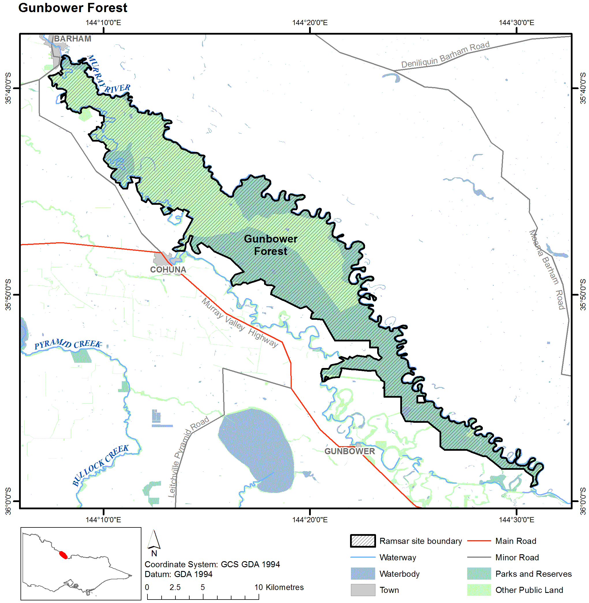
Gunbower Forest
Gunbower Forest
- Country:
- Australia
- Site number:
- 263
- Area:
- 20,180.0 ha
- Designation date:
- 15-12-1982
- Coordinates:
- 35°47'38"S 144°17'46"E
Carousel
Carousel")

Materials presented on this website, particularly maps and territorial information, are as-is and as-available based on available data and do not imply the expression of any opinion whatsoever on the part of the Secretariat of the Ramsar Convention concerning the legal status of any country, territory, city or area, or of its authorities, or concerning the delimitation of its frontiers or boundaries.
The Site is the second largest periodically-inundated red gum (Eucalyptus camaldulensis) forest in the Murray-Darling Basin in Victoria. It also has a variety of permanent and temporary wetlands such as lakes, swamps and lagoons, which support diverse wetland plants and provide habitat for at least 66 bird species. There are six nationally and internationally threatened species including silver perch (Bidyanus bidyanus), Murray cod (Maccullochella peelii), black box (Eucalyptus largiflorens) and Australasian bittern (Botaurus poiciloptilus). During flood periods, the Forest becomes a major breeding area for colonies of waterbirds such as ibis, herons and cormorants. It is also an important spawning area for fish that migrate along the Murray River. Human activities in the Site include recreational fishing, camping, hunting, silviculture and grazing. Threats to its ecological character include water abstraction, climate change, forestry activities, altered fire regimes, invasive species and recreational activities. There is a Site-specific management plan which aims to address the key threats related to water resource use and climate change. “The Living Murray”, one of Australia’s largest river restoration programmes, has helped to maintain the wetland and floodplain hydrology and improve the connectivity of different wetlands in and around the Site.
- National Park - Gunbower National Park
- Natural Features Reserve - Murray River Reserve
- State Forest - Gunbower Island State Forest
- AU263RIS_2304_en.pdf
- AU263RISformer_151029.pdf
- AU263_map1606.png
- AU263_map210428_1.pdf
- AU263ECD2013.pdf