Partie tchadienne du lac Tchad
Partie tchadienne du lac Tchad
- País:
- Chad
- Número del sitio:
- 1134
- Superficie:
- 1,648,168.0 ha
- Fecha de designación:
- 14-08-2001
- Coordenadas:
- 14°20'N 13°37'E
Carousel
Carousel


Los materiales presentados en este sitio web, particularmente los mapas y la información territorial, se proporcionan tal cual y según están disponibles a partir de los datos de los que se dispone y no implican la expresión de opinión alguna por parte de la Secretaría de la Convención de Ramsar respecto de la condición jurídica de ningún país, territorio, ciudad o zona, ni de sus autoridades, ni respecto de la delimitación de sus límites o fronteras.
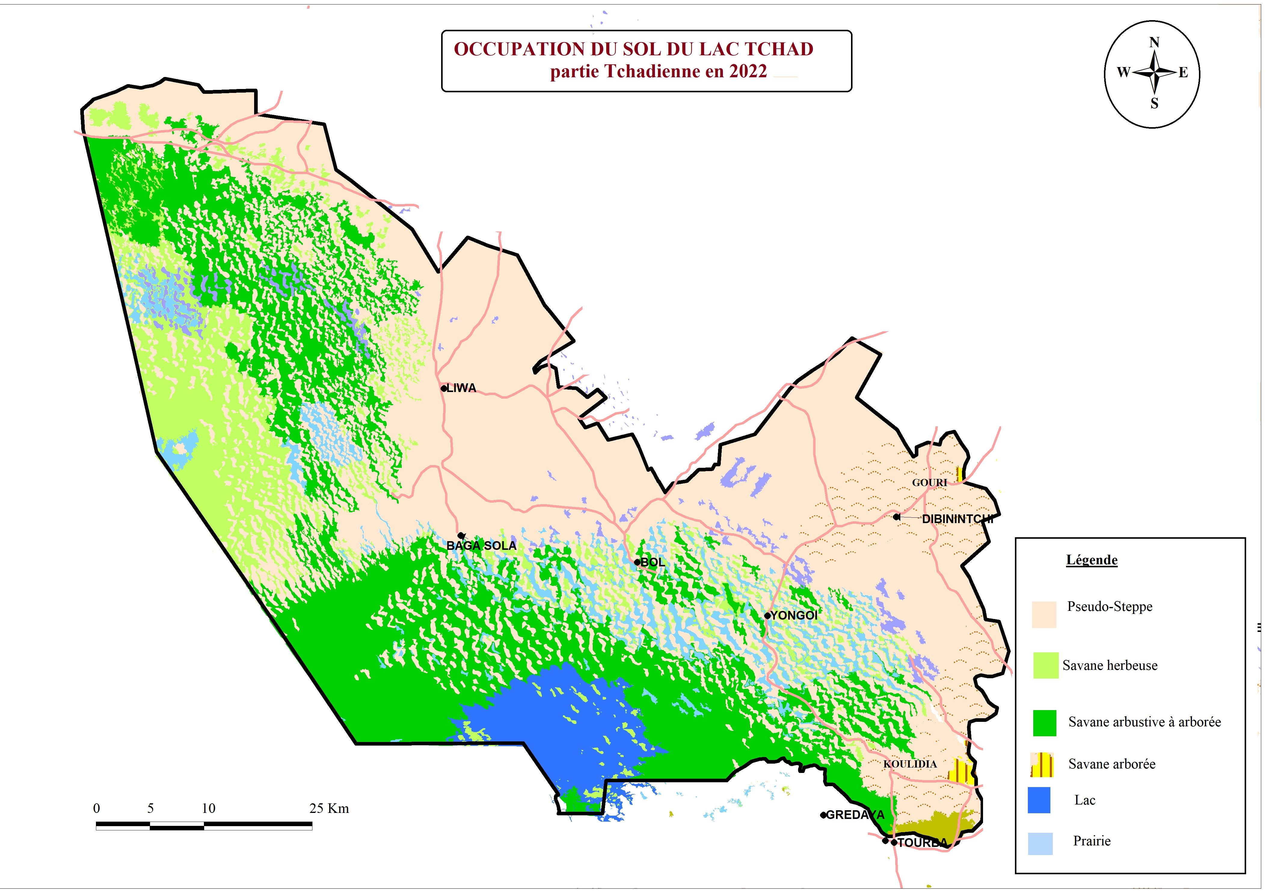
Partie tchadienne du lac Tchad. 14/08/01; Lac, Kenam; 1,648,168 ha; 14°20'N 013°37'E. A vast expanse of water bordered on the northwest by a cordon of dunes, on the northeast by an "erg" of shifting sand dunes, and on the south by flat lowlands. Lake Chad is shared with Cameroon, Niger, and Nigeria, and the Chadian portion covers a great variety of wetland types, including open waters, islets and sandbanks, polders, oases and temporary and permanent "natron" or alkalai pools. The endorrheic lake, as the only expanse of water of similar magnitude in the Sahara, is of immense importance to all life in the region and fulfills most of the Ramsar Criteria. The site supports internationally important numbers of waterbirds and is essential for some 150 fish species, and is the only place in the country that supports the endemic Kouri Ox, which is threatened by extinction through interbreeding. The lake also regulates the variability of annual water supply, recharges groundwater, and helps to control flooding. Of 300,000 fisherpeople in Chad, more than half of them live around Lake Chad, and the production of spiruline ("blue algae") and natron is economically important., as is the raising of cattle, sheep, and camels, and some agriculture. Desiccation and sanding over are seen as the main threats. Ramsar site no. 1134. Most recent RIS information: 2001.
Región administrativa:
préfectures du Lac et du Kanem
Fecha de última publicación:
14-08-2001
Ficha Informativa de los Humedales de Ramsar (FIR)
- TD1134RIS.pdf
- TD1134RISformer2001_EN.pdf
FIR archivada
Mapa del sitio