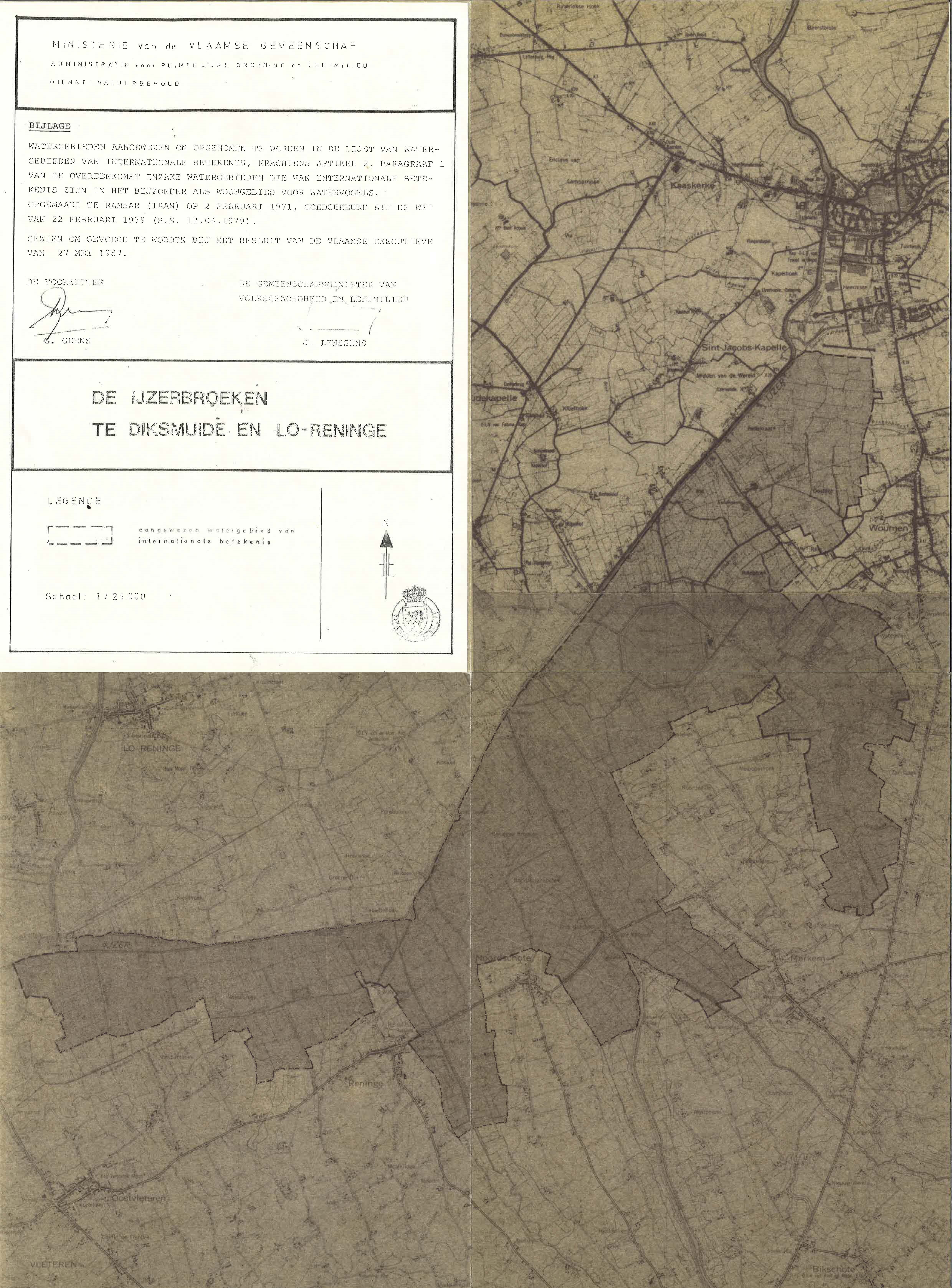
De Ijzerbroeken te Diksmuide en Lo-Reninge
De Ijzerbroeken te Diksmuide en Lo-Reninge
- País:
- Bélgica
- Número del sitio:
- 329
- Superficie:
- 2,360.0 ha
- Fecha de designación:
- 04-03-1986
- Coordenadas:
- 50°58'59"N 02°51'E
Los materiales presentados en este sitio web, particularmente los mapas y la información territorial, se proporcionan tal cual y según están disponibles a partir de los datos de los que se dispone y no implican la expresión de opinión alguna por parte de la Secretaría de la Convención de Ramsar respecto de la condición jurídica de ningún país, territorio, ciudad o zona, ni de sus autoridades, ni respecto de la delimitación de sus límites o fronteras.
De Ijzerbroeken te Diksmuide en Lo-Reninge. 04/03/86; Vlaamse Gewest, 2,360 ha, 50°59'N 002°51'E. Added to the Montreux Record, 4 July 1990, removed from the Record, 17 January 1994, replaced on the Record, 17 May 1999. Special Protection Area EC Directive; Nature Reserve. A shallow, freshwater lake resulting from peat-cutting since the 16th century. Composed of extensive reedbeds and scrub and surrounded by a wet meadow complex. The area supports an interesting flora including rare species, and is particularly important for breeding, staging and wintering birds; nesting species include ducks. The site includes a 60ha water-supply reservoir. Human activities include intense hunting and agriculture. Ramsar site no. 329. Most recent RIS information: 1992.
Región administrativa:
West-Vlaanderen
Designación jurídica nacional:
- nature reserve
Regional (international) legal designations:
- Natura 2000 (Unión Europea)
Fecha de última publicación:
01-01-1992
Ficha Informativa de los Humedales de Ramsar (FIR)
- BE329RIS.pdf
Mapa del sitio