Anzali Wetland
Anzali Wetland
- Pays:
- Iran (République islamique d')
- Numéro du site:
- 40
- Superficie:
- 19,500.0 ha
- Date d'inscription:
- 23-06-1975
- Coordonnées:
- 37°26'25"N 49°24'41"E
Carousel
Carousel and reed bed of Chokum Wildlife Refuge are seen. The building with red roof is Anzali Wetland Eco Tourism Center.")

 in the north of Anzali Wetland.")


 nests on the submerged aquatic plant in west lagoon of Anzali Wetland")
 nests on Water chestnuts leaves in Sorkhankol Wildlife Refuge")
 and Common Tern (Sterna hirundo) in West Lagoon")

 in Selke Wildlife Refuge. Hundreds of PS can be sometimes seen in front of reedbed in Anzali Wetland.")
 in West Lagoon. The biomass of the flog is very huge in the site which provides food s for other animals.")

Le matériel présenté sur ce site web, et en particulier les cartes et l’information territoriale, est tel qu’il apparaît dans les données disponibles et n’implique en aucune manière l’expression d’une opinion quelconque de la part du Secrétariat de la Convention de Ramsar concernant le statut juridique de tout pays, territoire, ville ou zone, ou de ses autorités, ou concernant la délimitation de ses frontières ou limites.
Séparé de la mer Caspienne par un système dunaire, ce site est constitué d’une vaste lagune d’eau douce alimentée par plusieurs cours d’eau en provenance des monts Talesh. La zone humide permanente est entourée de marais inondés de façon saisonnière ; principalement composés de roselières et de plantes à feuilles flottantes, ceux-ci représentent un habitat vital pour les oiseaux d’eau qui migrent le long des itinéraires aériens Afrique-Eurasie et Asie centrale. On a recensé sur le site quelque 140 000 oiseaux de 254 espèces, dont une très grande partie de la population régionale de cormorans, sternes, pélicans frisés (Pelecanus crispus), canards chipeau (Anas strepera) et sarcelles d’hiver (Anas crecca). On y trouve également 57 espèces de poissons, dont l’esturgeon étoilé (Acipenser stellatus), classé En danger critique d’extinction, et le barbeau de Bulatmai (Luciobarbus capito), classé Vulnérable. Nombre de ces poissons rejoignent cette zone humide pour y frayer, notamment le kutum de la mer Caspienne (Rutilus kutum) et l’ablette Kura (Alburnus filippii), deux espèces endémiques de la mer Caspienne et de ses bassins hydrographiques. Le site a été inscrit au Registre de Montreux en 1993 en raison d’une modification du niveau des eaux, d’un taux accru de nutriments, d’une augmentation de la chasse et de la propagation du roseau Phragmites australis et de la jacinthe d’eau, une espèce envahissante. Plusieurs mesures de restauration ont été mises en place avec le soutien de la communauté internationale pour lutter contre ces phénomènes.
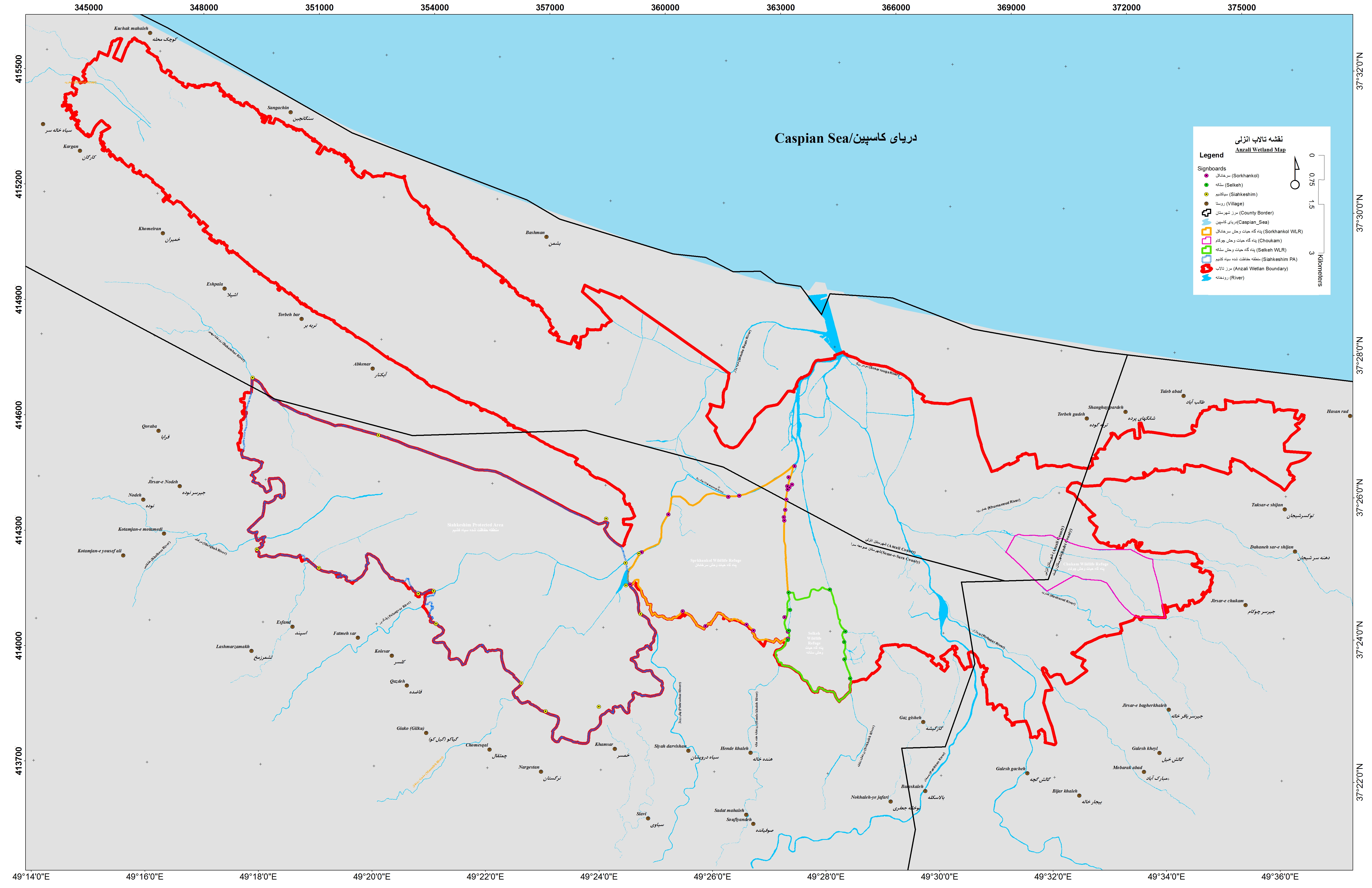
- protected area - Siahkesim Protected Area
- wildlife refuge - Chokum Wildlife Refuge
- wildlife refuge - Selkeh Wildlife Refuge
- wildlife refuge - Sorkhankol Wildlife Refuge
- IR40RIS_2304_en.pdf
- IR40RISformer_150428.pdf
- IR40_map180515.jpg