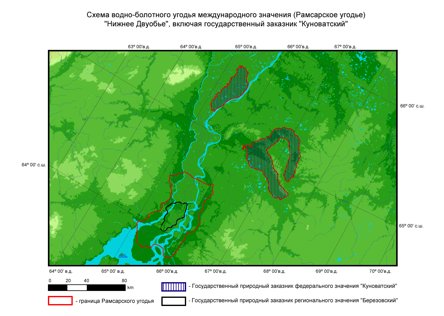
Lower Dvuobje
Lower Dvuobje
- Pays:
- Fédération de Russie
- Numéro du site:
- 677
- Superficie:
- 540,000.0 ha
- Date d'inscription:
- 13-09-1994
- Coordonnées:
- 64°31'59"N 65°46'E
Le matériel présenté sur ce site web, et en particulier les cartes et l’information territoriale, est tel qu’il apparaît dans les données disponibles et n’implique en aucune manière l’expression d’une opinion quelconque de la part du Secrétariat de la Convention de Ramsar concernant le statut juridique de tout pays, territoire, ville ou zone, ou de ses autorités, ou concernant la délimitation de ses frontières ou limites.
A unique valley network of river floodplains, islands, lakes and temporary water bodies (or "sors"), and an extended pseudodelta. Habitats include sedge-willow fens, associations of "sor" vegetation, swamp and peat meadows, shrubs and willows. The site, one of the richest waterbird habitat and nesting areas in the world, supports up to 500,000 waterbirds during migration. The site supports internationally important numbers of breeding and molting waterbirds, especially ducks and swans, and several threatened species. The wetlands provide important feeding areas for sturgeon and whitefish and support a rich mammal population. Human activities include cattle-grazing and haymaking, commercial fishing, fur trapping, timber harvesting, and conservation education.
Région administrative:
Khanty-Mansi and Yamalo-Nenets Autonomous Areas
Inscription légale nationale:
- Zakaznik - Beryozovsky State zakaznik of regional level
Date de dernière publication:
01-08-2008
Fiche descriptive Ramsar (FDR)
- RU677_RIS170704.pdf
FDR archivées