RIS Search

Map

Choose map: | | Download Centroids / Boundaries / Map (pdf)
Materials presented on this website, particularly maps and territorial information, are as-is and as-available based on available data and do not imply the expression of any opinion whatsoever on the part of the Secretariat of the Ramsar Convention concerning the legal status of any country, territory, city or area, or of its authorities, or concerning the delimitation of its frontiers or boundaries.

List

  1. Papyrus sur le fleuve Nyanga, Mougagara
    Chenal sur le fleuve Nyanga
    Navigation sur le fleuve Nyanga
    Paysage Mayonami
    Buffle de Setté-Cama près de Gamba
    Éléphant dans un site pétrolier
    Oiseau près de Mougagara
    Embouchure de Ndougou, site des pélicans
    Traversée des éléphants sur la Ndougou

    Setté Cama

    • Country: 
      Gabon
    • Designation date: 
      30-12-1986
    • Site number: 
      353
    • Published since: 
      7 year(s)
    240,000 ha
  2. Ramsar logo

    Basse-Mana

    • Country: 
      France (outre-mer)
    • Designation date: 
      08-12-1993
    • Site number: 
      643
    • Published since: 
      17 year(s)
    59,000 ha
  3. MARAIS DE CHAUTAGNE
    SENTIER SUR PILOTIS - MARAIS DE LAVOURS
    VUE SUR LE GRAND COLOMBIER DU MARAIS DE LAVOURS
    ÎLE DE CHAUTAGNE-MALOURDIE
    ÎLE DE CHAUTAGNE-MALOURDIE
    LAC DU BOURGET

    Lac du Bourget - Marais de Chautagne et de Lavours

    • Country: 
      France
    • Designation date: 
      02-02-2003
    • Site number: 
      1268
    • Published since: 
      0 year(s)
    6,949 ha
  4. Baie de Beheloka
    parcelle 7 et 8
    plage zone de ponte
    plage zone de ponte
    Dromas adreola
    Phaethon rubricauda
    Phaethon rubricauda
    Sterna bengalensis

    Barrière de Corail Nosy Ve Androka

    • Country: 
      Madagascar
    • Designation date: 
      02-02-2017
    • Site number: 
      2285
    • Published since: 
      7 year(s)
    91,445 ha
  5. Ramsar logo

    Awarua Wetland

    • Country: 
      New Zealand
    • Designation date: 
      13-08-1976
    • Site number: 
      102
    • Published since: 
      16 year(s)
    20,000 ha
  6. Prairie de fougère aigle (partie du nord du site)
    Pompage de l’eau pour l’irrigation des terres limitrophes

    Oum Lâagareb

    • Country: 
      Algeria
    • Designation date: 
      05-06-2011
    • Site number: 
      1959
    • Published since: 
      6 year(s)
    729 ha
  7. Rich fen at Storgjotkölen.

    Storkölen

    • Country: 
      Sweden
    • Designation date: 
      14-11-2001
    • Site number: 
      1129
    • Published since: 
      7 year(s)
    6,992 ha
  8. Ramsar logo

    Sarstoon Temash National Park

    • Country: 
      Belize
    • Designation date: 
      19-10-2005
    • Site number: 
      1562
    • Published since: 
      18 year(s)
    16,955 ha
  9. Ramsar logo

    Tram Chim National Park

    • Country: 
      Viet Nam
    • Designation date: 
      02-02-2012
    • Site number: 
      2000
    • Published since: 
      12 year(s)
    7,313 ha
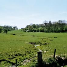
  10. Vallée de la Haute-Sûre

    • Country: 
      Luxembourg
    • Designation date: 
      08-03-2004
    • Site number: 
      1408
    • Published since: 
      21 year(s)
    16,900 ha

Pages

Stats


Exports

Export Sites information

For a summary list of all the Ramsar Sites in pdf format, click here.

Generate reports of selected Sites

You can generate a report based on the filters you have applied, in either pdf or xls format. The report will sort the results by the Site name, unless you have sorted them by another variable.

For the pdfs, you can choose whether to include the introductory text on each Site, or just show the key data in a shorter report.

To receive a report, please provide your email address and enter the text in the verification picture into the textbox.

As soon as the list has been generated an e-mail will be sent to you with the link to access the file.