Search results
Search found 119 Ramsar Sites covering 8,306,231 ha
- (-) Remove Region/country: Europe filter Region/country: Europe
- (-) Remove Region/country: Slovakia filter Region/country: Slovakia
- (-) Remove Region/country: North Macedonia filter Region/country: North Macedonia
- (-) Remove Region/country: Czech Republic filter Region/country: Czech Republic
- (-) Remove Region/country: Oceania filter Region/country: Oceania
- (-) Remove Threats: Human intrusions & disturbance filter Threats: Human intrusions & disturbance
- (-) Remove Region/country: Poland filter Region/country: Poland
- (-) Remove Region/country: Netherlands (Kingdom of the) filter Region/country: Netherlands (Kingdom of the)
Map
Materials presented on this website, particularly maps and territorial information, are as-is and as-available based on available data and do not imply the expression of any opinion whatsoever on the part of the Secretariat of the Ramsar Convention concerning the legal status of any country, territory, city or area, or of its authorities, or concerning the delimitation of its frontiers or boundaries.
List
-

Rottige Meenthe and Brandemeer
-
Country:Netherlands (Kingdom of the)
-
Designation date:29-08-2000
-
Site number:1277
-
Published since:1 year(s)
1,369 ha -
-

Voordelta
-
Country:Netherlands (Kingdom of the)
-
Designation date:29-08-2000
-
Site number:1279
-
Published since:1 year(s)
92,271 ha -
-

Voornes Duin
-
Country:Netherlands (Kingdom of the)
-
Designation date:29-08-2000
-
Site number:1280
-
Published since:1 year(s)
1,432 ha -
-

Zuidlaardermeergebied
-
Country:Netherlands (Kingdom of the)
-
Designation date:29-08-2000
-
Site number:1282
-
Published since:1 year(s)
2,087 ha -
-
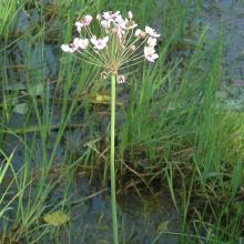
Tisa River
-
Country:Slovakia
-
Designation date:04-12-2004
-
Site number:1411
-
Published since:19 year(s)
735 ha -
-


 roosting on Manawatū Estuary sandspit at high tide")
Manawatū River mouth and estuary
-
Country:New Zealand
-
Designation date:25-07-2005
-
Site number:1491
-
Published since:1 year(s)
600 ha -
-


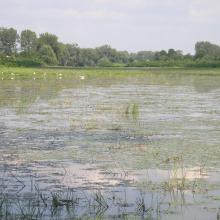
Druzno Lake Nature Reserve
-
Country:Poland
-
Designation date:29-10-2002
-
Site number:1563
-
Published since:5 year(s)
3,068 ha -
-


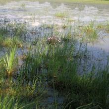
Narew River National Park
-
Country:Poland
-
Designation date:29-10-2002
-
Site number:1564
-
Published since:5 year(s)
6,810 ha -
-


Poleski National Park
-
Country:Poland
-
Designation date:29-10-2002
-
Site number:1565
-
Published since:5 year(s)
9,762 ha -
-


Krkonoše/Karkonosze Subalpine peatbogs
-
Country:Poland
-
Designation date:29-10-2002
-
Site number:1566
-
Published since:4 year(s)
40 ha -