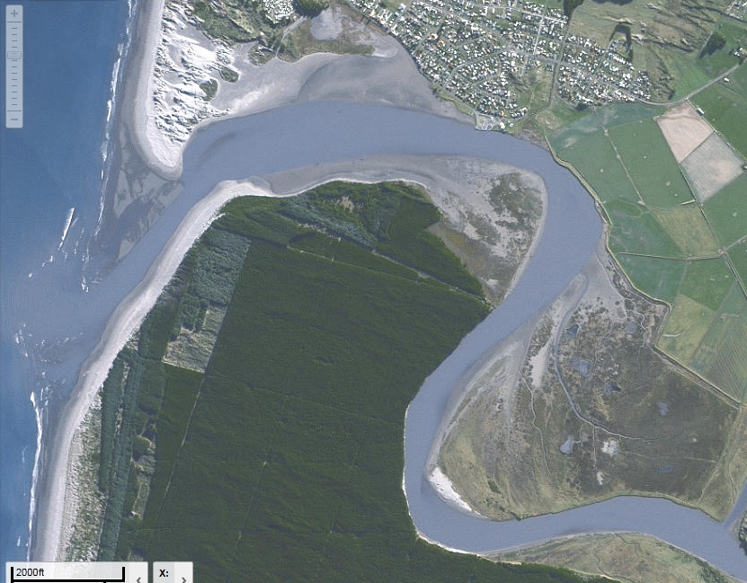
Manawatū River mouth and estuary
Manawatū River mouth and estuary
- Country:
- New Zealand
- Site number:
- 1491
- Area:
- 600.0 ha
- Designation date:
- 25-07-2005
- Coordinates:
- 40°28'50"S 175°13'58"E
Carousel
Carousel


 roosting on Manawatū Estuary sandspit at high tide")
Materials presented on this website, particularly maps and territorial information, are as-is and as-available based on available data and do not imply the expression of any opinion whatsoever on the part of the Secretariat of the Ramsar Convention concerning the legal status of any country, territory, city or area, or of its authorities, or concerning the delimitation of its frontiers or boundaries.
The Site is one of the largest estuaries on the North Island and retains a high degree of naturalness and endemic biodiversity. It consists of sandflats, estuary waters and intertidal marshes that support rare communities of tidal flat herb-fields and coastal marsh, dominated by ribbonwood (Plagianthus divaricatus) and jointed wire-rush (Apodasmia similis). Human disturbance is limited by the Site’s inaccessibility, which has helped to maintain large populations of threatened Australasian bitterns (Botaurus poiciloptilus) and fernbirds (Megalurus punctatus). Fifteen freshwater and ten estuarine fish either inhabit or migrate to the Site, many of them threatened or rare such as Galaxiidae and New Zealand longfin eel (Anguilla dieffenbachia). The Site is nationally important for migratory shorebirds, with at least 95 species recorded here. A significant proportion of the regional population of wrybill (Anarhynchus frontalis) breeds in the Site. In the decade to 2023, however, the international migrant shorebird numbers declined, in particularly of the red knot (Calidris canutus). Invasive plants and increasing tourist and agricultural activities pose potential threats, but measures to address these with local stakeholders’ cooperation are progressing and a Site-specific management plan has been prepared.
- Conservation Area - Foxton Conservation Area
- NZ1491RIS_2304_en.pdf
- NZ1491RISformer_150311.pdf
- NZ1491map_over.pdf
- NZ1491_map160726.jpg
- NZ1491_taxo180109.doc
- NZ1491_mgt180110.pdf