Search results
Search found 252 Ramsar Sites covering 22,154,363 ha
- (-) Remove Ramsar criteria: 6 filter Ramsar criteria: 6
- (-) Remove Threats: Water regulation filter Threats: Water regulation
- (-) Remove Wetland type: Inland wetlands filter Wetland type: Inland wetlands
- (-) Remove Wetland type: Human-made wetlands filter Wetland type: Human-made wetlands
- (-) Remove Wetland type: W: Shrub-dominated wetlands filter Wetland type: W: Shrub-dominated wetlands
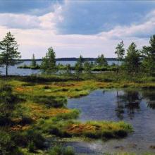
Map
Materials presented on this website, particularly maps and territorial information, are as-is and as-available based on available data and do not imply the expression of any opinion whatsoever on the part of the Secretariat of the Ramsar Convention concerning the legal status of any country, territory, city or area, or of its authorities, or concerning the delimitation of its frontiers or boundaries.
List
-


Songor Ramsar Site
-
Country:Ghana
-
Designation date:14-08-1992
-
Site number:566
-
Published since:0 year(s)
51,133 ha -
-

Lough Neagh & Lough Beg
-
Country:United Kingdom of Great Britain and Northern Ireland
-
Designation date:05-01-1976
-
Site number:74
-
Published since:19 year(s)
50,166 ha -
-
Hamun-e-Saberi & Hamun-e-Helmand
-
Country:Iran (Islamic Republic of)
-
Designation date:23-06-1975
-
Site number:42
-
Published since:19 year(s)
50,000 ha -
-


Lake Shkodra and River Buna
-
Country:Albania
-
Designation date:02-02-2006
-
Site number:1598
-
Published since:18 year(s)
49,562 ha -
-

Matsalu
-
Country:Estonia
-
Designation date:29-03-1994
-
Site number:104
-
Published since:3 year(s)
48,610 ha -
-


Lubana wetland complex
-
Country:Latvia
-
Designation date:27-03-2003
-
Site number:1384
-
Published since:21 year(s)
48,020 ha -
-


La Dombes
-
Country:France
-
Designation date:22-03-2023
-
Site number:2500
-
Published since:1 year(s)
47,659 ha -
-


Mangroves de Tsiribihina
-
Country:Madagascar
-
Designation date:22-05-2017
-
Site number:2302
-
Published since:7 year(s)
47,218 ha -
-
Lake Burullus
-
Country:Egypt
-
Designation date:09-09-1988
-
Site number:408
-
Published since:32 year(s)
46,200 ha -
-
 of 230 km2
Figure 1
Route: Lusnic – Celebic – Donji Kazanci")


Livanjsko Polje
-
Country:Bosnia and Herzegovina
-
Designation date:11-04-2008
-
Site number:1786
-
Published since:16 year(s)
45,868 ha -