Search results
Map
Materials presented on this website, particularly maps and territorial information, are as-is and as-available based on available data and do not imply the expression of any opinion whatsoever on the part of the Secretariat of the Ramsar Convention concerning the legal status of any country, territory, city or area, or of its authorities, or concerning the delimitation of its frontiers or boundaries.
List
-


Vallée de la Haute-Sûre
-
Country:Luxembourg
-
Designation date:08-03-2004
-
Site number:1408
-
Published since:21 year(s)
16,900 ha -
-


Vallée de la Haute-Sûre
-
Country:Belgium
-
Designation date:08-03-2004
-
Site number:1407
-
Published since:9 year(s)
29,000 ha -
-
")
")
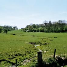
Grotte des Emotions
-
Country:Belgium
-
Designation date:24-03-2003
-
Site number:1406
-
Published since:20 year(s)
3 ha -
-


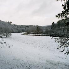
Les Hautes Fagnes
-
Country:Belgium
-
Designation date:24-03-2003
-
Site number:1405
-
Published since:9 year(s)
9,974 ha -
-


![[from left] Gerhard Sigmund (Ramsar Coordinator in the Ministry of Environment), Gert Michael Steiner (Institute of Ecology and Conservation Biology, University of Vienna), Reinhold Turk (Environment Ministry of Styria), Gerald Plattner (Nature Protection Unit of the Austrian Federal Forests-ÖBf AG)](https://rsis.ramsar.org/sites/default/files/styles/risv_medium/public/RISapp/files/56632882/pictures/3AT017pic8.jpg?itok=-v3nFSmi "[from left] Gerhard Sigmund (Ramsar Coordinator in the Ministry of Environment), Gert Michael Steiner (Institute of Ecology and Conservation Biology, University of Vienna), Reinhold Turk (Environment Ministry of Styria), Gerald Plattner (Nature Protection Unit of the Austrian Federal Forests-ÖBf AG)")

Moore am Nassköhr
-
Country:Austria
-
Designation date:11-10-2004
-
Site number:1404
-
Published since:19 year(s)
211 ha -
-


Polissia Mires
-
Country:Ukraine
-
Designation date:17-11-2003
-
Site number:1403
-
Published since:3 year(s)
2,145 ha -
-

-Sphagneta formations")

Perebrody Peatlands
-
Country:Ukraine
-
Designation date:17-11-2003
-
Site number:1402
-
Published since:7 year(s)
12,718 ha -
-


Lower Smotrych River
-
Country:Ukraine
-
Designation date:17-11-2003
-
Site number:1401
-
Published since:2 year(s)
1,480 ha -
-


Lake Synevyr
-
Country:Ukraine
-
Designation date:17-11-2003
-
Site number:1400
-
Published since:1 year(s)
29 ha -
-


Dnipro-Oril Floodplains
-
Country:Ukraine
-
Designation date:17-11-2003
-
Site number:1399
-
Published since:3 year(s)
2,560 ha -