Search results
Search found 70 Ramsar Sites covering 21,174,827 ha
- (-) Remove Wetland type: Inland wetlands filter Wetland type: Inland wetlands
- (-) Remove Ramsar criteria: 6 filter Ramsar criteria: 6
- (-) Remove Threats: Unspecified/others filter Threats: Unspecified/others
- (-) Remove Ramsar criteria: 3 filter Ramsar criteria: 3
- (-) Remove Picture available?: Yes filter Picture available?: Yes
Map
Materials presented on this website, particularly maps and territorial information, are as-is and as-available based on available data and do not imply the expression of any opinion whatsoever on the part of the Secretariat of the Ramsar Convention concerning the legal status of any country, territory, city or area, or of its authorities, or concerning the delimitation of its frontiers or boundaries.
List
-


Lac du barrage de Boughezoul
-
Country:Algeria
-
Designation date:05-06-2011
-
Site number:1960
-
Published since:5 year(s)
9,058 ha -
-


Vransko Lake
-
Country:Croatia
-
Designation date:02-02-2013
-
Site number:2109
-
Published since:5 year(s)
5,748 ha -
-


Kitsissunnguit
-
Country:Denmark (Greenland)
-
Designation date:27-01-1988
-
Site number:384
-
Published since:5 year(s)
6,910 ha -
-
 of 230 km2
Figure 1
Route: Lusnic – Celebic – Donji Kazanci")


Livanjsko Polje
-
Country:Bosnia and Herzegovina
-
Designation date:11-04-2008
-
Site number:1786
-
Published since:16 year(s)
45,868 ha -
-


Nemunas Delta
-
Country:Lithuania
-
Designation date:20-08-1993
-
Site number:629
-
Published since:14 year(s)
28,952 ha -
-


Helge å
-
Country:Sweden
-
Designation date:05-12-1974
-
Site number:16
-
Published since:7 year(s)
8,042 ha -
-


Svartådalen
-
Country:Sweden
-
Designation date:12-06-1989
-
Site number:436
-
Published since:6 year(s)
1,977 ha -
-
 et le Fanel (à droit du canal) avec les zones humides et la lagune.")
 .")
Fanel et Chablais de Cudrefin
-
Country:Switzerland
-
Designation date:16-01-1976
-
Site number:79
-
Published since:7 year(s)
1,155 ha -
-
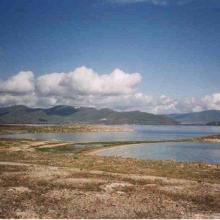


Lake Sevan
-
Country:Armenia
-
Designation date:07-06-1993
-
Site number:620
-
Published since:13 year(s)
490,231 ha -
-


Zvanets
-
Country:Belarus
-
Designation date:21-10-2002
-
Site number:1219
-
Published since:8 year(s)
16,227 ha -