


 Cinclodes antarcticus antarcticus")
")


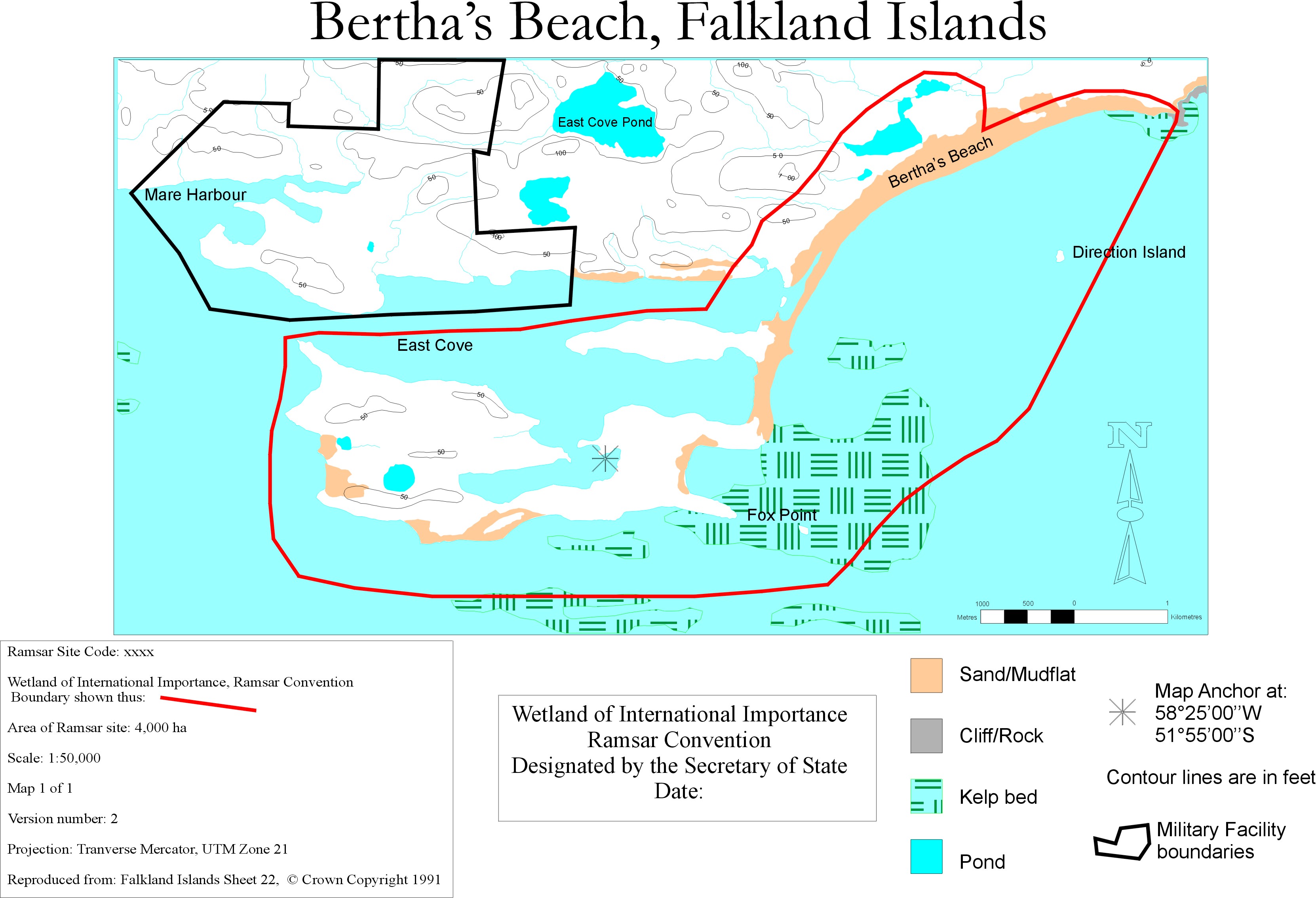
Bertha's Beach
- Country:United Kingdom of Great Britain and Northern Ireland (Overseas territories)
- Site number:1103
- Area:3,000 ha
- Designation date:24-09-2001
- Coordinates:51°54'S 58°24'W
Materials presented on this website, particularly maps and territorial information, are as-is and as-available based on available data and do not imply the expression of any opinion whatsoever on the part of the Secretariat of the Ramsar Convention concerning the legal status of any country, territory, city or area, or of its authorities, or concerning the delimitation of its frontiers or boundaries.
Overview
The Site features a dynamic sandy beach, and significant areas of shallow marine water, reefs to the south-east and sheltered marine lagoons to the north. It is a representative example of Falkland coastal wetland types, including beach, small lakes, shallow marine ecosystems and tussac islands. It supports a broad range of Falkland birds and plants, including the endemic Falkland steamer duck (Tachyeres brachypterus) and other endemic sub-species of waterfowl, as well as gentoo penguin (Pygoscelis papua) colonies. Among its plants is the endemic and globally endangered vanilla daisy (Erigeron incertus). Grazing by sheep has led to impoverishment of the native flora, and in some instances to erosion of the thin soils. At Bertha’s Beach pilot studies are being carried out on improving techniques for plant species introduction. The area has enormous potential for conservation education for military and civilian visitors.
Administrative region:
East Falkland
- National legal designation:
- none
- Last publication date:10-01-2024
Downloads
Ramsar Information Sheet (RIS)
Archived RIS
Site map
Additional reports and documents
- Other published literature