


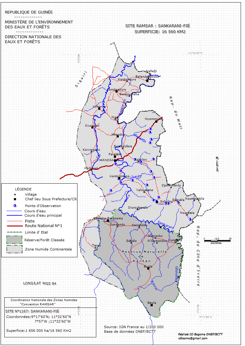
Sankarani-Fié
- Country:Guinea
- Site number:1167
- Area:1,656,000 ha
- Designation date:17-01-2002
- Coordinates:10°19'N 08°32'W
Materials presented on this website, particularly maps and territorial information, are as-is and as-available based on available data and do not imply the expression of any opinion whatsoever on the part of the Secretariat of the Ramsar Convention concerning the legal status of any country, territory, city or area, or of its authorities, or concerning the delimitation of its frontiers or boundaries.
Overview
The Site, within the basin of the Sankarani River, is located in the east of the country next to the border with Côte d'Ivoire. It is characterized by savannah and dry forest, and enormous floodplains along the length of the river. This stretch of the river is an important fish spawning ground because the current is calm, deep and well protected by gallery forests. It is also a refuge for spur-winged goose (Plectropterus gambensis), white-faced whistling duck (Dendrocygna viduata), cattle egret (Bubulcus ibis), little egret (Egretta garzetta) and African jacana (Actophilornis africana). Hippopotamuses have also become numerous within the Site because of water retained by the Sélingué dam. However, extensive agriculture accompanied by the use of fires, exploitation of gold and prohibited fishing practices have all contributed to the destruction of vegetation cover and an increasing scarcity of wildlife.
Administrative region:
Préf. de Kankan
- National legal designation:
- Réserve naturelle gérée
- Last publication date:28-03-2017
Downloads
Ramsar Information Sheet (RIS)
Archived RIS
Site map
Additional reports and documents
- Other published literature