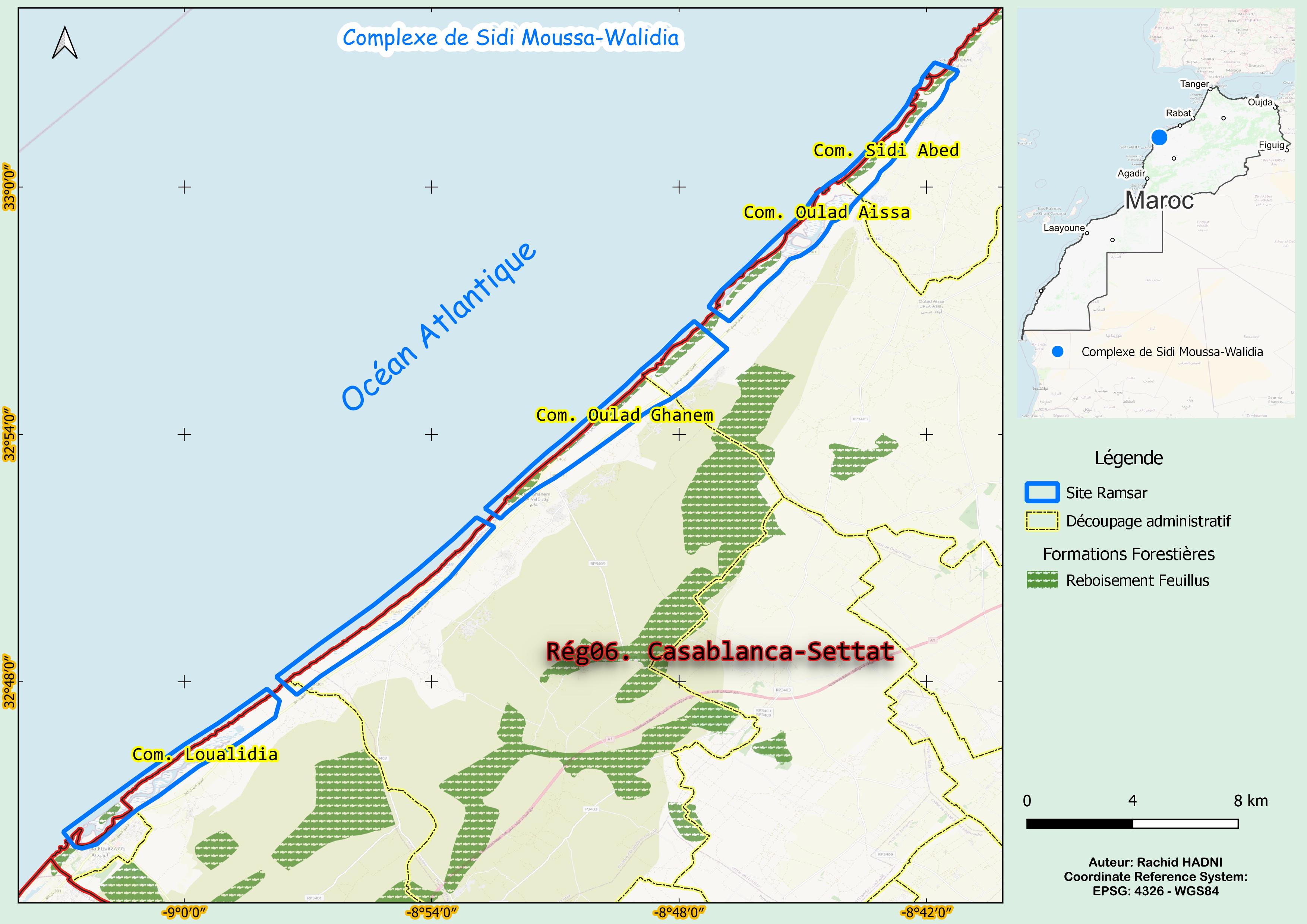
Complexe de Sidi Moussa-Walidia
Complexe de Sidi Moussa-Walidia
- Country:
- Morocco
- Site number:
- 1474
- Area:
- 5,350.0 ha
- Designation date:
- 15-01-2005
- Coordinates:
- 32°53'08"N 08°51'30"W
Carousel
Carousel


Materials presented on this website, particularly maps and territorial information, are as-is and as-available based on available data and do not imply the expression of any opinion whatsoever on the part of the Secretariat of the Ramsar Convention concerning the legal status of any country, territory, city or area, or of its authorities, or concerning the delimitation of its frontiers or boundaries.
The Sidi Moussa-Walidia wetland complex, on the Atlantic coast in Al Jadida Province, is made up of a chain of discrete wetlands separated from the ocean by a belt of active dunes that extends some 50 kilometres from the village of Sidi El Abed to the small town of Walidia. The complex includes two lagoons and four marshes and salt pans. To the east, the furrow is flanked by a hillside rising up to 80 metres. It is a key habitat for many noteworthy species, such as the Moroccan spadefoot toad (Pelobates varaldii) and various waterbirds such as the gull-billed tern (Gelochelidon nilotica), black-winged stilt (Himantopus himantopus), black-crowned night-heron (Nycticorax nycticorax) and the endangered marbled duck (Marmaronetta angustirostris). The wetlands also provide drinking water to local communities and water for livestock and agriculture. The Site is a centre for recreation (hunting and fishing) as well as a cultural heritage site and modern scientific research centre, highlighting its socioeconomic and ecological significance.
- Permanent Hunting Reserve
- Site of Biological and Ecological Interest
- Zone of Interest for the Conservation of Birds
- MA1474RIS_2501_fr.pdf
- MA1474RISformer_160218.pdf