Zones humides de Souss-Massa
Zones humides de Souss-Massa
- Country:
- Morocco
- Site number:
- 1487
- Area:
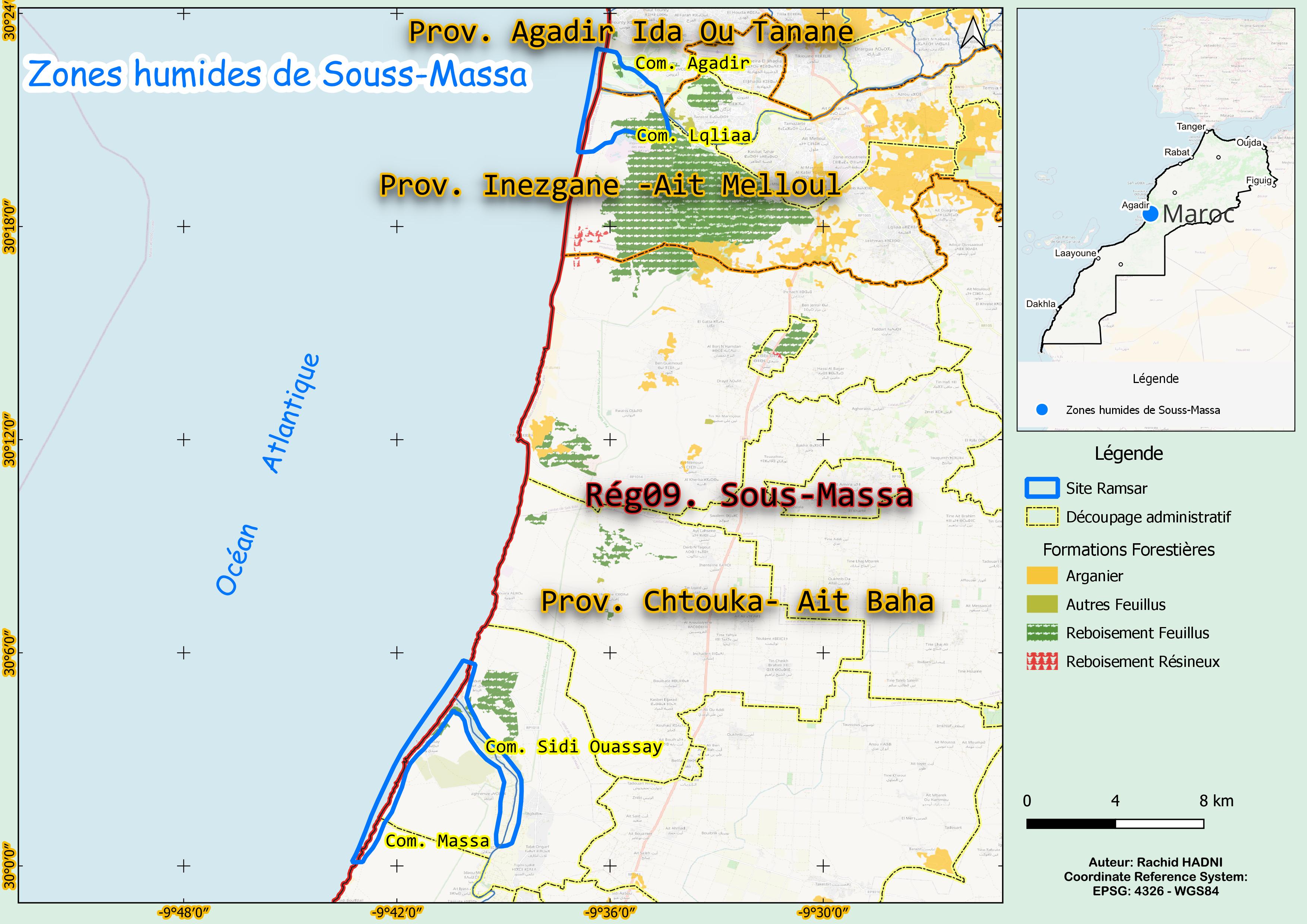
- 2,830.0 ha
- Designation date:
- 15-01-2005
- Coordinates:
- 30°11'35"N 09°38'16"W
Carousel
Carousel


Materials presented on this website, particularly maps and territorial information, are as-is and as-available based on available data and do not imply the expression of any opinion whatsoever on the part of the Secretariat of the Ramsar Convention concerning the legal status of any country, territory, city or area, or of its authorities, or concerning the delimitation of its frontiers or boundaries.
This wetland complex within the Souss-Massa National Park consists of two separate areas featuring diverse habitats, including dunes, freshwater and brackish marshes, coastal waters, sandy beaches and rocky shores. The Site is also designated as a Permanent Hunting Reserve. Originally identified to protect the endangered northern bald ibis (Geronticus eremita), of which 7% of the biogeographic population is present, the Site has since been recognized as an important refuge for over 270 bird species, including the marbled teal (Marmaronetta angustirostris). Agriculture dominates the landscape, particularly banana plantations and livestock farming, while ecotourism and coastal tourism are also significant. However, urban pollution and disturbance from both local people and tourists pose growing threats to the wetland’s ecological integrity.
- National Park - Parc National de Souss-Massa
- Permanent Hunting Reserve
- MA1487RIS_2503_fr.pdf
- MA1487RISformer_220830.pdf
- MA1487_map230807.jpg
- MA1487_taxo161004.docx