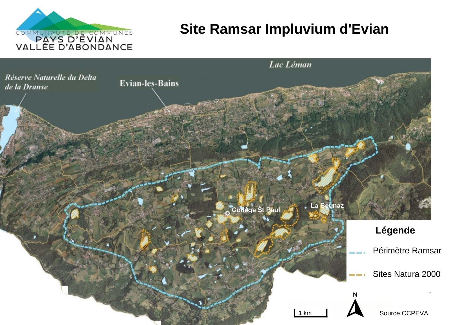
Impluvium d'Evian
Impluvium d'Evian
- Country:
- France
- Site number:
- 1833
- Area:
- 3,275.0 ha
- Designation date:
- 15-09-2008
- Coordinates:
- 46°21'55"N 06°36'23"E
Carousel
Carousel


Materials presented on this website, particularly maps and territorial information, are as-is and as-available based on available data and do not imply the expression of any opinion whatsoever on the part of the Secretariat of the Ramsar Convention concerning the legal status of any country, territory, city or area, or of its authorities, or concerning the delimitation of its frontiers or boundaries.
The Site is composed of seasonal and permanent freshwater marshes, forested and non-forested peatlands, rivers and streams. It is in the heart of a plateau where the popular mineral waters of Evian have their origin as rainwater is absorbed in the soil. During the infiltration process it is purified and redistributed underground, feeding the aquifer. In addition, this network of wetlands contributes to the maintenance of an exceptional hydrological system, feeding the groundwater that gives rise to Evian’s mineral waters. Although the Site does not support an outstanding number of species, it provides an important habitat for invertebrates, including the nationally endangered butterfly Coenonynpha tullia. The extension of agricultural land and the construction of drainage systems have also led to occasional changes in hydrological functioning.
- Arrêté Préfectoral de Protection de Biotope
- EU Natura 2000
- FR1833RIS_2307_fr.pdf
- FR1833RISformer_170728.pdf
- FR1833_map230523.jpg
- FR1833_taxo230523.pdf
- FR1833_mgt230315.pdf
- FR1833_mgt230315_1.pdf