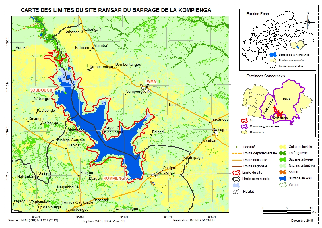
Barrage de la Kompienga
Barrage de la Kompienga
- Country:
- Burkina Faso
- Site number:
- 1875
- Area:
- 17,545.0 ha
- Designation date:
- 07-10-2009
- Coordinates:
- 11°11'N 00°36'59"E
Carousel
Carousel


Materials presented on this website, particularly maps and territorial information, are as-is and as-available based on available data and do not imply the expression of any opinion whatsoever on the part of the Secretariat of the Ramsar Convention concerning the legal status of any country, territory, city or area, or of its authorities, or concerning the delimitation of its frontiers or boundaries.
Situated in the east of the country, the Site comprises a permanent freshwater lake, as well as human-made features including several irrigated land areas and a dam which is principally used for the production of hydroelectricity. The presence of the dam has allowed for diversification of income generating activities, to include fishing, and crop and livestock farming. The Site is also home to a variety of flora and fauna. Threatened animal species include hippopotamus, lion and black crowned crane. The site also hosts the vulnerable African mahogany Khaya senegalensis. It is known to support over 20,000 water birds; at least 7,000 waders and 15,000 from the Anatidae family have been recorded. The most frequent birds are Bubulcus ibis, Egretta garzetta, Phalacrocorax africanus, and Anatidae such as Dendrocygna viduata, Dendrocygna bicolor, Sarkidiornis melanotos and Plectropterus gambensis. Various threats affect the Site, including considerable erosion, declining fish yields, and increasing levels of eutrophication due to pollution from livestock and cotton cultivation. The fishery developed rapidly, following a strong demand for fresh fish linked to the growing needs in the big cities of Burkina Faso. This development led many fishers to set up around the lake. A management plan was drafted in 2005, but is not yet being implemented. Communication, education and awareness activities are carried out by the departments of water, forests and agriculture, and fisheries resources, village associations, and project stakeholders.
Administrative region:
à cheval entre la Région de l'Est (en grande partie) et la région du Centre-Est
Last publication date:
27-04-2017
Ramsar Information Sheet (RIS)
- BF1875RIS_1704_fr.pdf
- BF1875RISformer_160725.pdf
Archived RIS
Site map