Songdo Tidal Flat
Songdo Tidal Flat
- Country:
- Republic of Korea
- Site number:
- 2209
- Area:
- 611.0 ha
- Designation date:
- 10-07-2014
- Coordinates:
- 37°23'26"N 126°38'58"E
Carousel
Carousel
Materials presented on this website, particularly maps and territorial information, are as-is and as-available based on available data and do not imply the expression of any opinion whatsoever on the part of the Secretariat of the Ramsar Convention concerning the legal status of any country, territory, city or area, or of its authorities, or concerning the delimitation of its frontiers or boundaries.
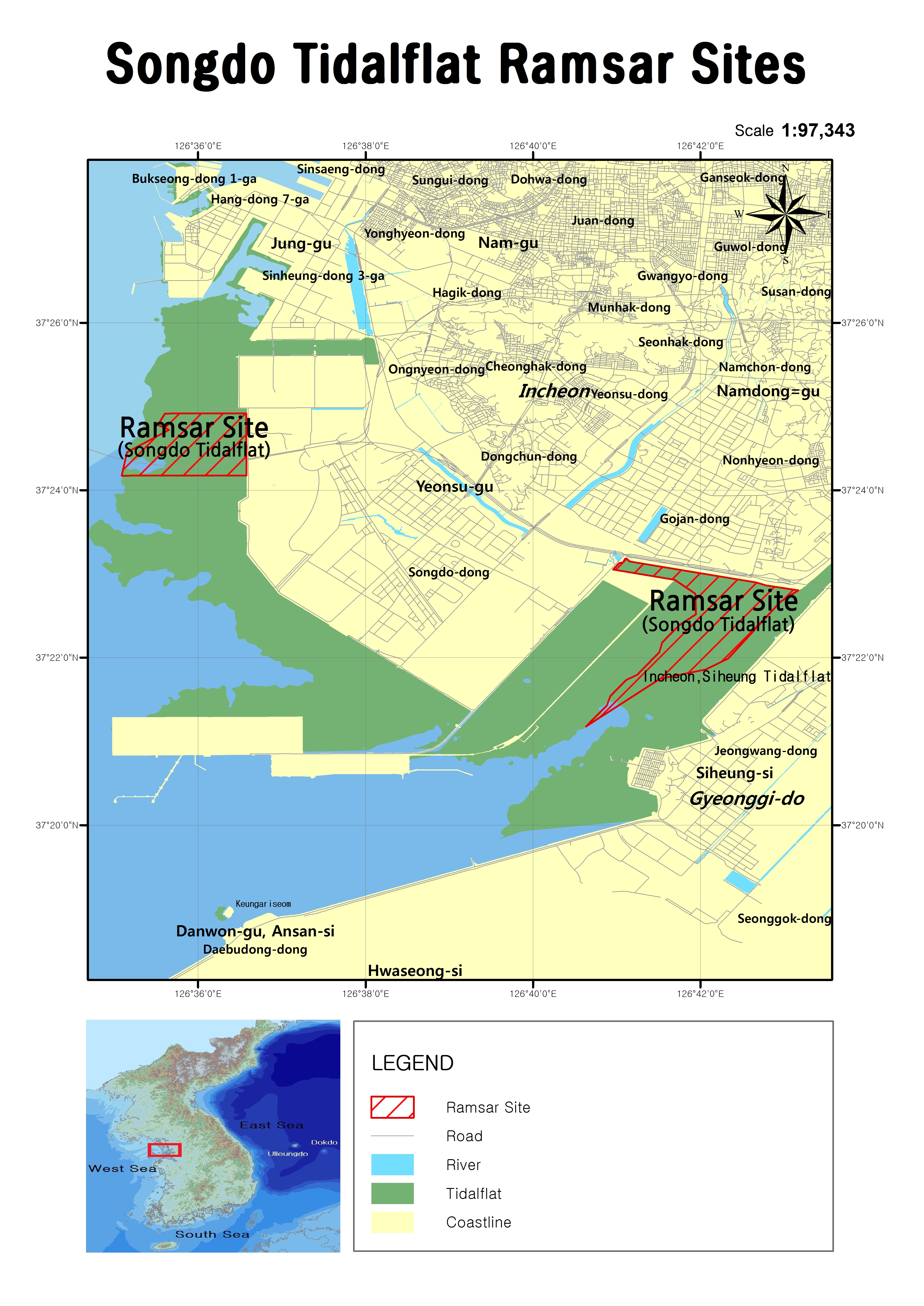
Songdo Tidal Flat. 10/07/2014; Incheon; 611 ha; 37°24’26”N 126°35’58”E. Coastal Wetland Protected Area. The Site includes two sections of a larger area of tidal mud flat along the coast of Incheon Metropolitan City, which has a complicated coastline with about 170 large and small islands. It is an important feeding and roosting ground for threatened waterbirds such as endangered black-face spoonbill (Platalea minor) as well as the vulnerable far eastern curlew (Numenius madagascariensis), great knot (Calidris tenuirostris) and Saunders’s gull (Larus saundersi). It also regularly supports 1% of the population of the Eurasian curlew Numenius arquata as well as of the far eastern curlew. Traditionally, the Site has been used by fishermen and clam collectors, who fish with their bare hands. Major species collected are the surf clam (Mactra veneriformis), corb shell (Cyclina sinensis) and Manila clam (Ruditapes philippinarum). Threats to the Site include reclamation and the building of facilities at the adjacent Songdo International City. Ramsar Site no. 2209. Most recent RIS information: 2014.
Administrative region:
Incheon Metropolitan City
National legal designation:
- Coastal Wetland Protected Area - Songdo Tidal Flat Coastal Wetland Protected Area
Last publication date:
15-04-2015
Ramsar Information Sheet (RIS)
- KR2209RIS_1504_en.pdf
- KR2209_map1409.jpg
Site map
Additional reports and documents
Other published literature