Hanbando Wetland Ramsar Site
Hanbando Wetland Ramsar Site
- Country:
- Republic of Korea
- Site number:
- 2226
- Area:
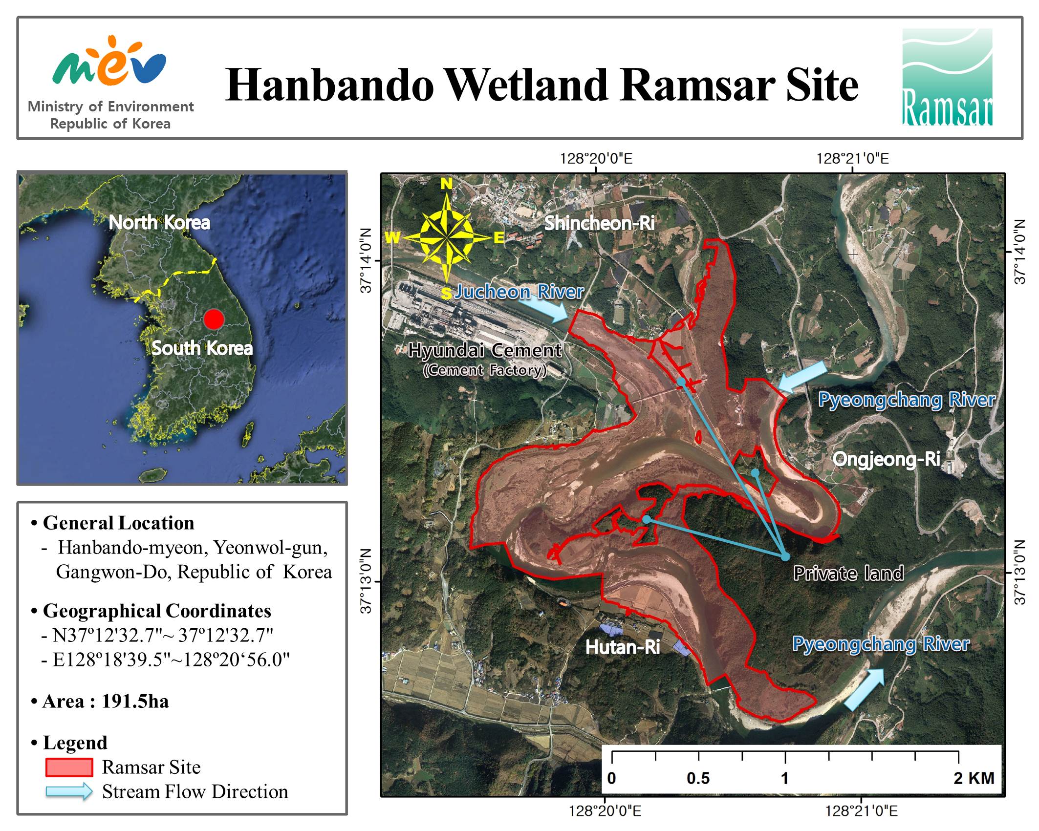
- 191.5 ha
- Designation date:
- 13-05-2015
- Coordinates:
- 37°13'16"N 128°20'14"E
Carousel
Carousel


Materials presented on this website, particularly maps and territorial information, are as-is and as-available based on available data and do not imply the expression of any opinion whatsoever on the part of the Secretariat of the Ramsar Convention concerning the legal status of any country, territory, city or area, or of its authorities, or concerning the delimitation of its frontiers or boundaries.
The Hanbando Wetland is representative of natural riverine wetlands in the Republic of Korea. The Site, lying in a sand-gravel bar formed in an incised meander, consists of various types of riffles and pools that maintain a rich biodiversity and provide habitats for numerous species including a number of endemic and nationally threatened species. The Site mostly lies on limestone through which groundwater aquifers are formed and recharged. The water that flows through Hanbando Wetland is collected at a nearby water harvesting plant that supplies the majority of drinking water for locals. The wetland has also long supported local agricultural industry. The name ‘Hanbando’ signifies that the wetland resembles the shape of the Korean Peninsula, which increases the Site’s symbolic value.
Administrative region:
Gangwon-do (province)
National legal designation:
- Protected Area - Hanbando Wetland Protection Area
Last publication date:
21-05-2015
Ramsar Information Sheet (RIS)
- KR2226RIS_1505_en.pdf
Site map