


Lagune de Wendu Tcham
- Country:Guinea-Bissau
- Site number:2230
- Area:14,970.2 ha
- Designation date:22-05-2015
- Coordinates:11°51'N 14°09'W
Materials presented on this website, particularly maps and territorial information, are as-is and as-available based on available data and do not imply the expression of any opinion whatsoever on the part of the Secretariat of the Ramsar Convention concerning the legal status of any country, territory, city or area, or of its authorities, or concerning the delimitation of its frontiers or boundaries.
Overview
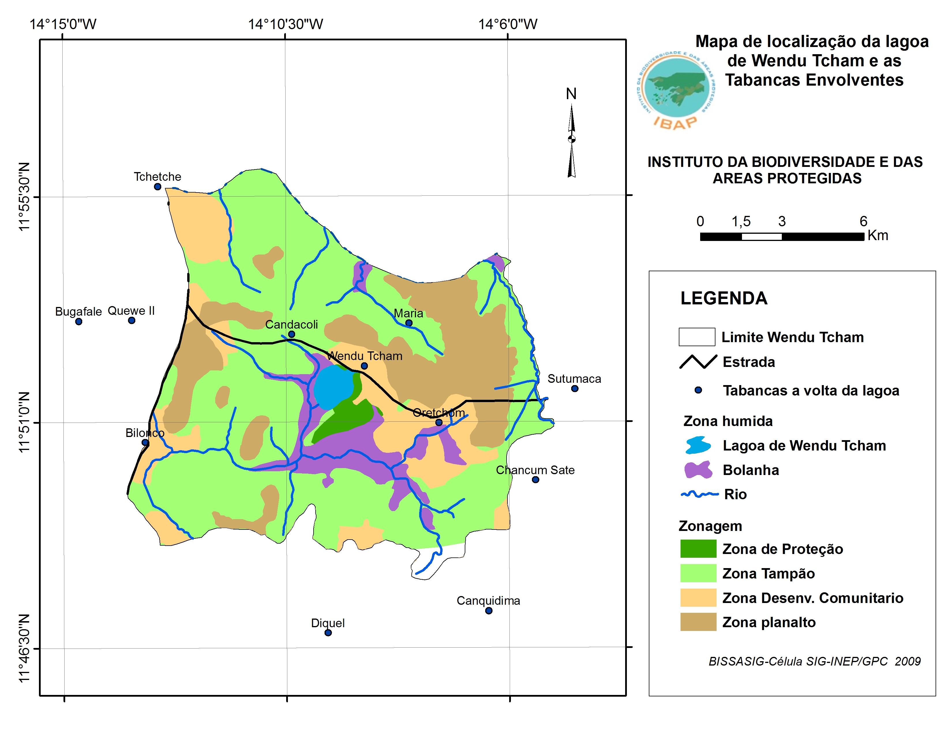
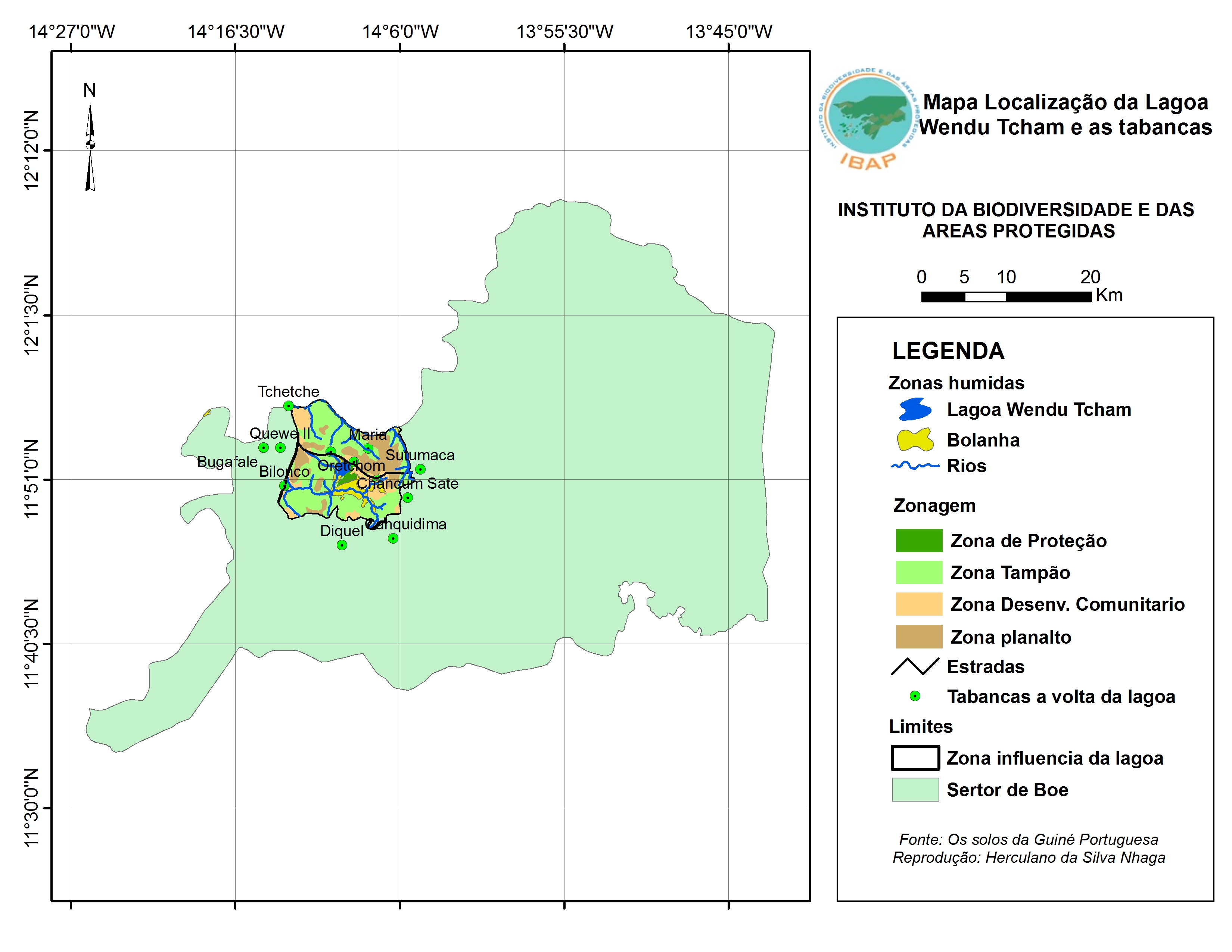
The Lagune de Wendu Tcham (Lagoa de Wendu Tcham) is a unique water reservoir fed by many tributaries and surrounded by a series of hills with flat peaks and open valleys. It is the largest freshwater zone in Guinea-Bissau after the Cufada Lagoon. The impermeable rocks on which it lies allow for a large water retention making Wendu Tcham the only lake of its kind which does not dry up all year round. The main hydrological functions of the Site include ground water recharge and discharge, erosion reduction and flood control. The fauna of Wendu Tcham is abundant and very diverse, with about 34 mammal and 200 bird species. Located right inside the migration corridor of the greatest concentration of large mammals along the coast, Wendu Tcham is home to many vulnerable and protected species including the African elephant (Loxodonta africana), lion (Panthera leo), hippopotamus (Hippopotamus amphibius), red-fronted gazelle (Eudorcas rufifrons), the endangered African wild dog (Lycaon pictus), and the near-threatened leopard (Panthera pardus). The aquatic vegetation also provides safe habitat for many species of fish, shellfish and reptiles. Subsistence agriculture developed on the slopes of some hills and banks of the lake coupled with traditional fishing are the only noticeable human activities in the Site. Because of the low human population density, the anthropogenic pressures on the Site are not high; as a result its ecological balance is relatively well maintained.
Administrative region:
Région de Gabú, secteur administratif de Boé
- Last publication date:28-05-2015
Downloads
Ramsar Information Sheet (RIS)
Additional reports and documents
- Taxonomic lists of plant and animal species occurring in the site