

Sawa Lake
- Country:Iraq
- Site number:2240
- Area:500 ha
- Designation date:03-03-2014
- Coordinates:31°18'N 45°00'E
Materials presented on this website, particularly maps and territorial information, are as-is and as-available based on available data and do not imply the expression of any opinion whatsoever on the part of the Secretariat of the Ramsar Convention concerning the legal status of any country, territory, city or area, or of its authorities, or concerning the delimitation of its frontiers or boundaries.
Overview
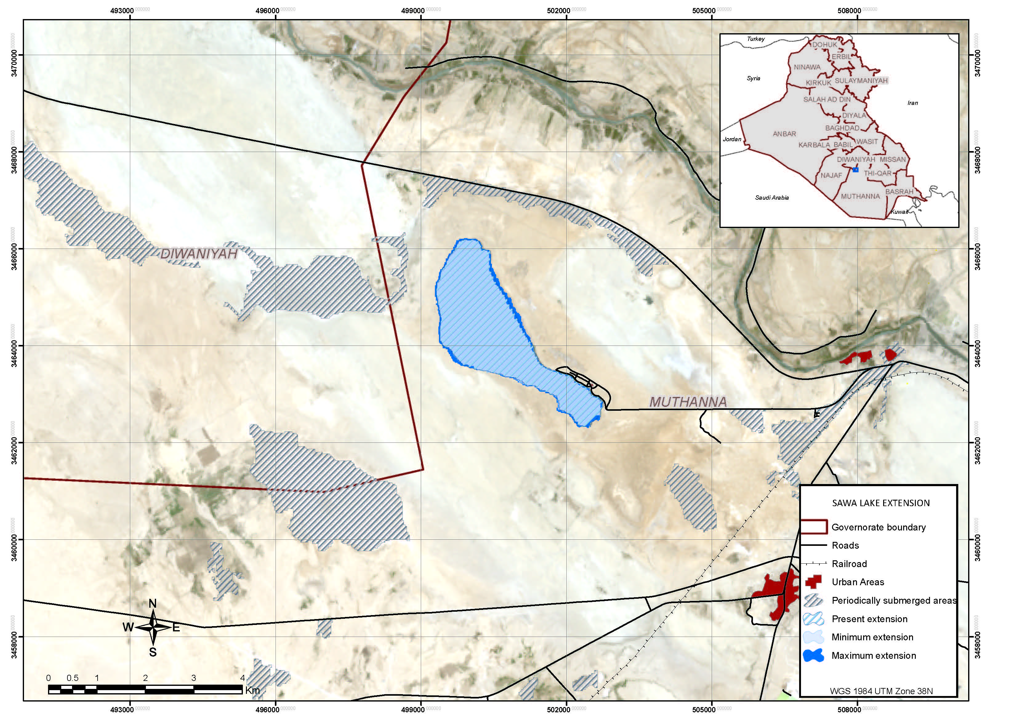
Sawa Lake is a permanent lake located in the western field of the Mesopotamian Plains, near the border with the Western Desert. The lake is unique for the biogeographic region because it is a closed water body in an area of sabkha (salt flat) with no inlet or outlet. It is normally only fed by groundwater that originates from the higher western desert areas, though it can also be temporarily fed by local wadis when heavy rain in the desert area causes flash floods. The lake is formed over limestone rock and is isolated by gypsum barriers surrounding the lake; its water chemistry is unique. The Site is home to several globally vulnerable species, namely eastern imperial eagle (Aquila heliaca), houbara bustard (Chlamydotis undulata) and marbled duck (Marmaronetta angustirostris). As Sawa Lake is the only water body nearby Samawa City it is a popular picnic and excursion area. However, these recreational activities threaten to lead to accumulation of solid waste, and disturb the wildlife including the nesting and migrating birds because of the poor vegetation cover in the surrounding zones.
Administrative region:
Muthanna Governorate
- Last publication date:01-09-2015
Downloads
Ramsar Information Sheet (RIS)
Site map
Additional reports and documents
- A description of the site in a national or regional wetland inventory