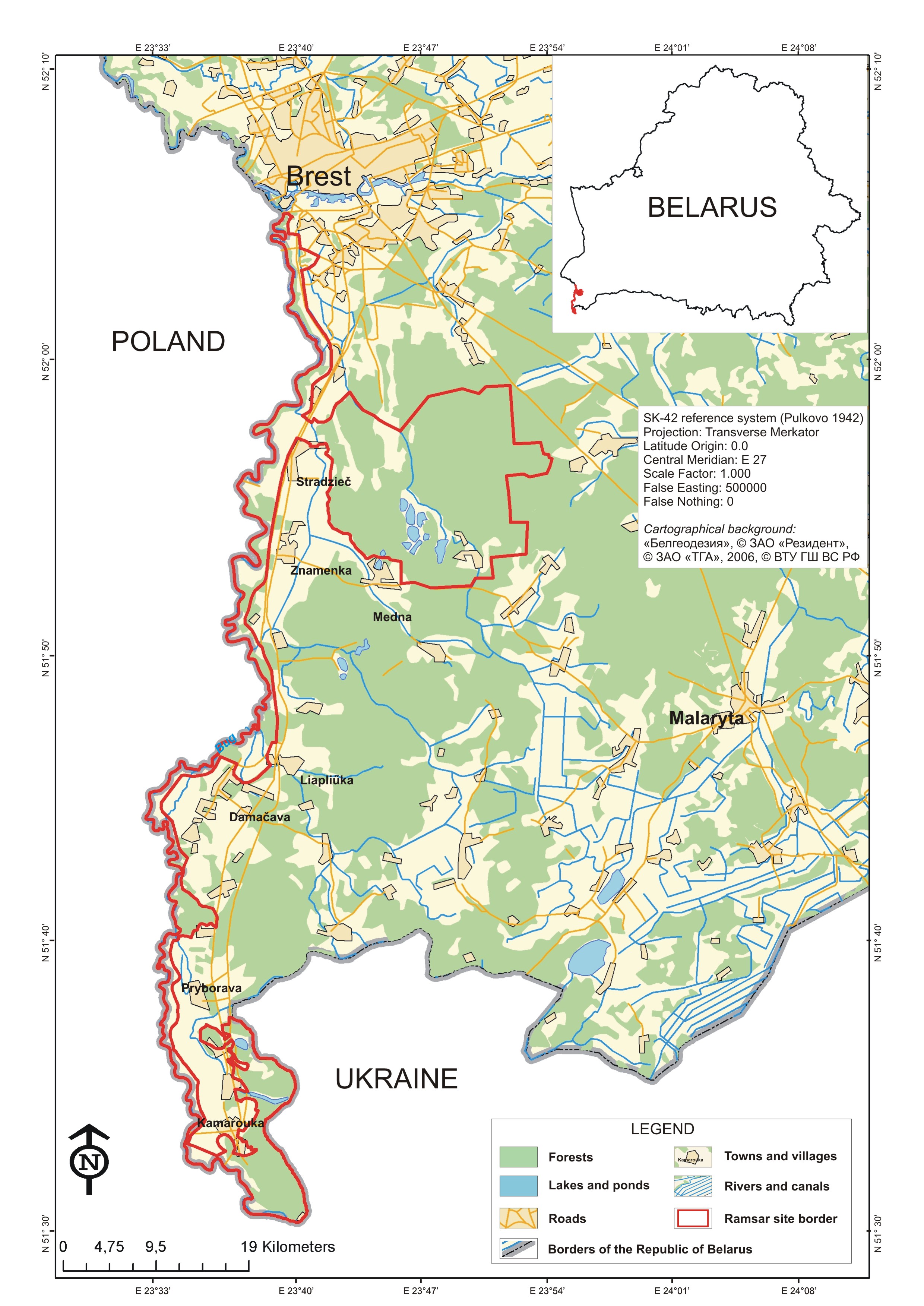
Polesye Valley of River Bug
Polesye Valley of River Bug
- Country:
- Belarus
- Site number:
- 2252
- Area:
- 23,159.0 ha
- Designation date:
- 29-05-2014
- Coordinates:
- 51°50'13"N 23°42'52"E
Carousel
Carousel
Materials presented on this website, particularly maps and territorial information, are as-is and as-available based on available data and do not imply the expression of any opinion whatsoever on the part of the Secretariat of the Ramsar Convention concerning the legal status of any country, territory, city or area, or of its authorities, or concerning the delimitation of its frontiers or boundaries.
Located along the middle reach of the Western Bug river, the Site encompasses the part in Belarus of a floodplain which follows the border with Poland and Ukraine. It is composed primarily of freshwater tree-dominated wetlands and open water bodies including the Western Bug, but it also includes meadows and open mires. The river has been preserved in its natural state with numerous meanders and oxbows, and the Site is representative of wetlands of the Continental biogeographic region. 209 bird species have been recorded, of which at least 167 are nesting, as well as four bat species and 700 vascular plant species. The Site is also of great importance for the passage of fish including Barbus barbus and Vimba vimba to spawning grounds. The wetland plays important roles across the river basin, in groundwater discharge and recharge and in water purification. The main activities focus on forestry, fishing and nature-based tourism and recreation. The Site features the “stradach” fish farm, a large complex of old fishponds and two natural lakes which is one of the oldest of its type in Belarus. Several archaeological sites related to the Golendras colonies of the beginning of the 16th Century are located within the wetland. The main threats relate to intensive forestry, drainage, the construction of dams, the late filling and full reconstruction of fish ponds and the overgrowth of open mires with shrubs due to the cessation of mowing. An integrative system has been developed to monitor the river, its ecosystems and the threats it faces.
Administrative region:
Brest Region/Brest District
National legal designation:
- Republican Landscape Reserve - Pribuzhskoye Polesie
Regional (international) legal designations:
- Other international designation
Last publication date:
15-01-2016
Ramsar Information Sheet (RIS)
- BY2252RIS_1601_en.pdf
Site map