Viruá National Park
Viruá National Park
- Country:
- Brazil
- Site number:
- 2295
- Area:
- 216,427.0 ha
- Designation date:
- 22-03-2017
- Coordinates:
- 01°17'28"N 61°09'07"W
Carousel
Carousel


Materials presented on this website, particularly maps and territorial information, are as-is and as-available based on available data and do not imply the expression of any opinion whatsoever on the part of the Secretariat of the Ramsar Convention concerning the legal status of any country, territory, city or area, or of its authorities, or concerning the delimitation of its frontiers or boundaries.
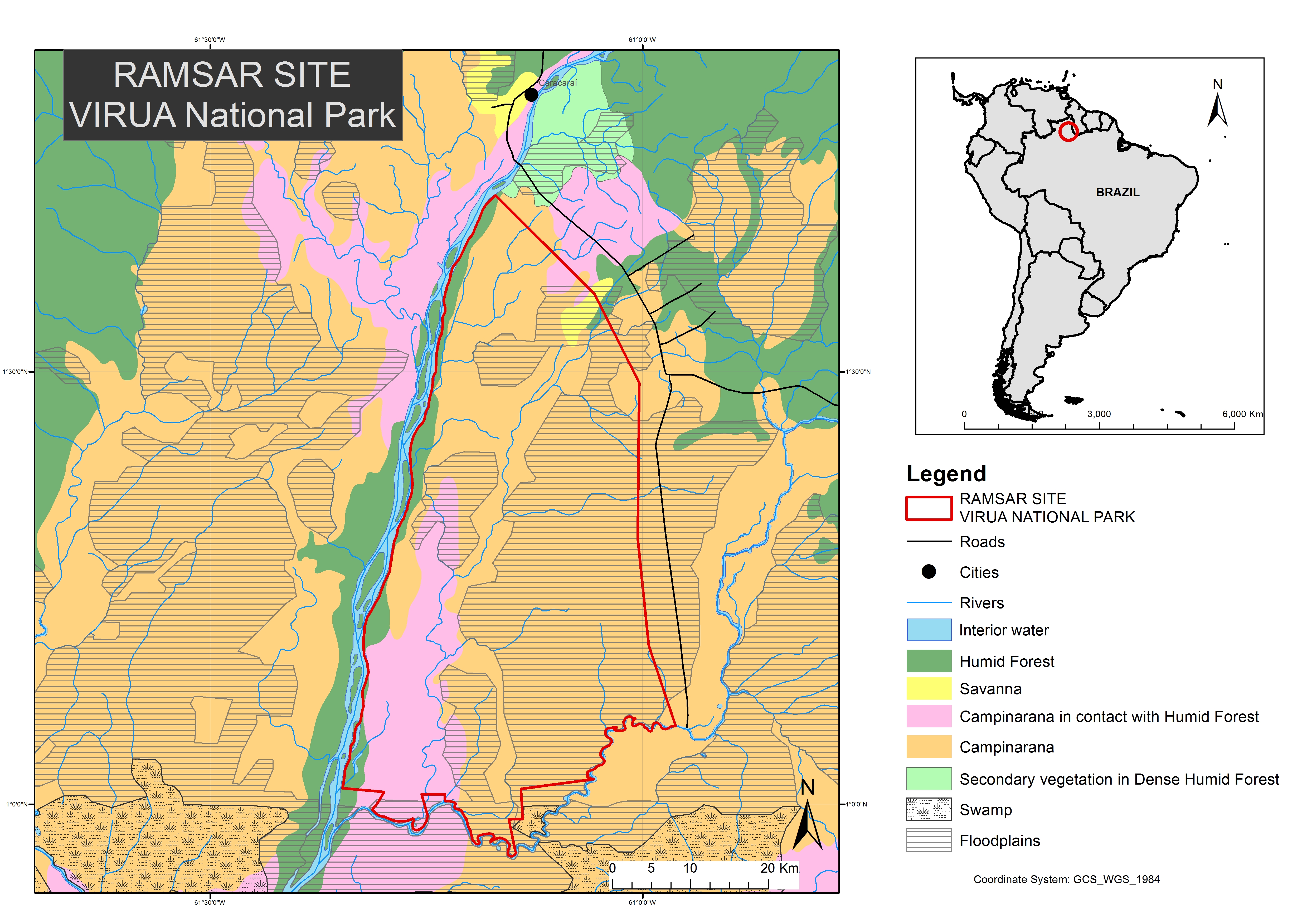
Viruá National Park is in the megadiverse “Campinaranas”ecological region, on the lower Rio Branco (“White River”) within the Rio Negro basin. It covers a mosaic of forested and non-forested humid ecosystems, which are representative of a unique geo-ecological system in the Amazon, and play important roles in flood control, sediment deposition and other natural cycles. The Site presents exceptional levels of biodiversity, especially of fish with 500 species recorded, and birds with over 530 species recorded of which 28 are endemic. It provides important fishing resources. The Site hosts populations of species such as the endangered giant otter (Pteronura brasiliensis) and the near-threatened jaguar (Panthera onca).
Administrative region:
Iss located in the south-central region of the State of Roraima, in the Municipality of Caracaraí.
National legal designation:
- National Park - Viruá National Park
Last publication date:
10-07-2017
Ramsar Information Sheet (RIS)
- BR2295RIS_1707_en.pdf
- BR2295_map170322.jpg
Site map
Additional reports and documents
Other published literature