Guaratuba
Guaratuba
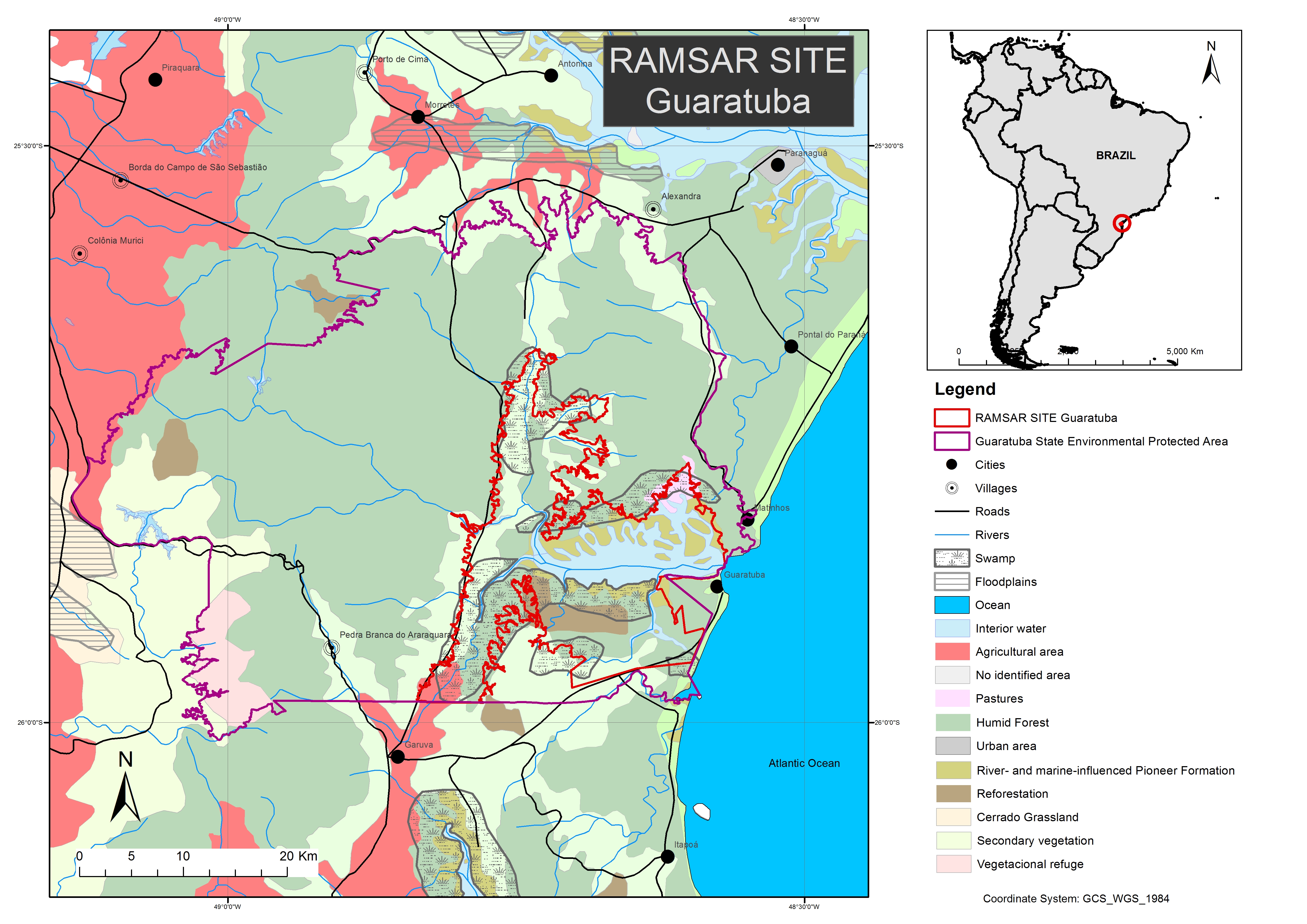
- Country:
- Brazil
- Site number:
- 2317
- Area:
- 38,329.3 ha
- Designation date:
- 21-09-2017
- Coordinates:
- 25°51'30"S 48°41'58"W
Carousel
Carousel
Materials presented on this website, particularly maps and territorial information, are as-is and as-available based on available data and do not imply the expression of any opinion whatsoever on the part of the Secretariat of the Ramsar Convention concerning the legal status of any country, territory, city or area, or of its authorities, or concerning the delimitation of its frontiers or boundaries.
The Site, located on the southernmost coast of the state of Paraná, is considered the most important area for the Paraná antwren (Stymphalornis acutirostris), of which it hosts about 42% of the global population. It features well preserved mangroves, periodically flooded forests, marshes and over 3,000 hectares of the last remains of caixeta (Tabebuia cassinoides) forests. Although it can be considered a well-preserved habitat compared to other bays in Brazil, threats such as overfishing, pollution, unregulated tourism and occupation of areas of mangrove are present.
- UNESCO Biosphere Reserve
- mosaic of conservation units - Lagamar
- protected area - Guaratuba Environmental Protection Area (EPA)
- BR2317RIS_1710_en.pdf
- BR2317_map170901.jpg