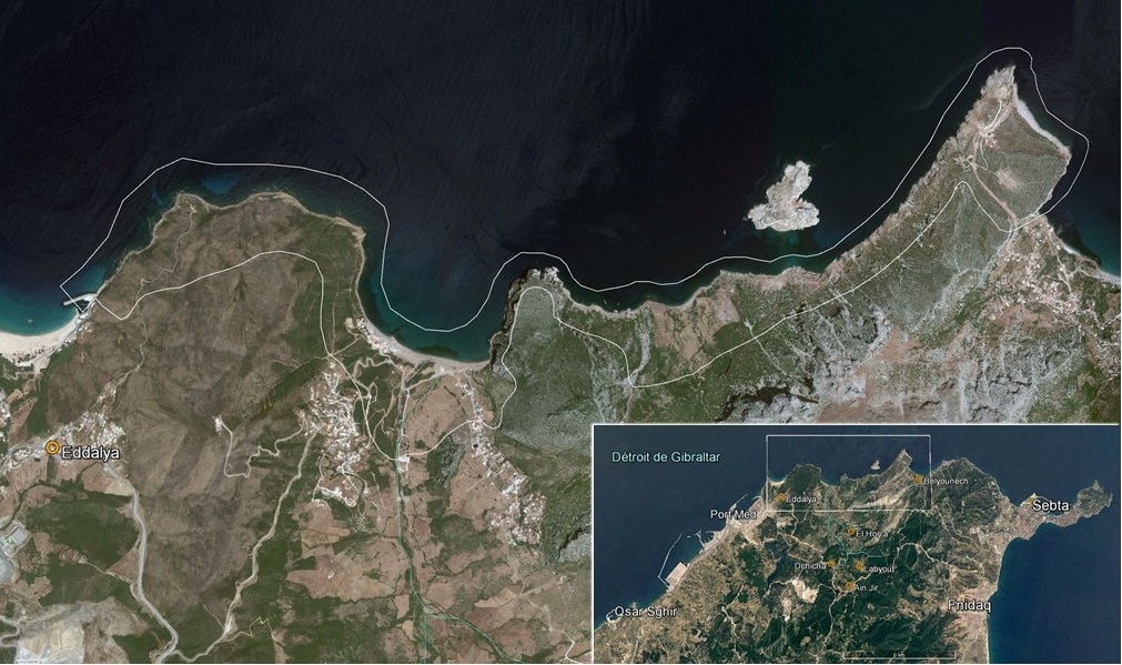
Littoral de Jbel Moussa
Littoral de Jbel Moussa
- Country:
- Morocco
- Site number:
- 2381
- Area:
- 500.0 ha
- Designation date:
- 16-04-2019
- Coordinates:
- 35°54'37"N 05°26'W
Carousel
Carousel


Materials presented on this website, particularly maps and territorial information, are as-is and as-available based on available data and do not imply the expression of any opinion whatsoever on the part of the Secretariat of the Ramsar Convention concerning the legal status of any country, territory, city or area, or of its authorities, or concerning the delimitation of its frontiers or boundaries.
The Site consists of a stretch of coastline with two mountains separated by a valley (Oued El Marsa) on the southern shore of the Strait of Gibraltar, where the Atlantic meets the Mediterranean. The wetland’s marine and coastal cliff ecosystems are rich in fauna (at least 175 taxa) and flora. It is an important area for the passage of sea turtles, birds (raptors and passerines) and mammals, and as a spawning ground for several fish species. It is home to some 24 rare or notable fish, and threatened species of anthozoa such as Corallium rubrum or Ellisella paraplexauroides. Notable terrestrial mammals include the endangered Barbary macaque (Macaca sylvanus). Subjected to strong winds, the cliffs are sparsely vegetated, by plants including endemics such as Stauracanthus boivinii and Rupicapnos africana. The coastline also has great landscape value, and cultural value in the agglomeration of Belyounech, which still retains vestiges of a prosperous medieval town. The Site is also a UNESCO Biosphere Reserve.
- UNESCO Biosphere Reserve
- MA2381RIS_1907_fr.pdf
- MA2381_map190316.jpg